
As we close in on the official start of Summer later this week, let’s take a look at how the Upper Midwest will fare over the next couple of days.
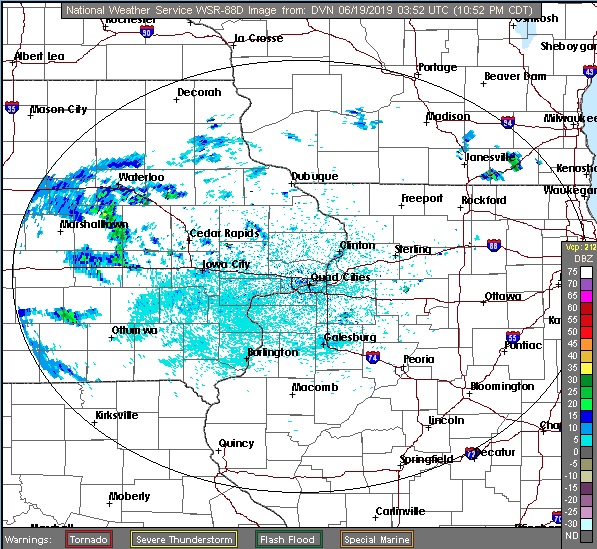
At 953pm CDT, the temperature at Dubuque, IA was 68 degrees under mostly cloudy skies. A weak boundary continues to linger from Michigan through IA back into the Central Plains. It’s the focus of scattered shower and isolated thunderstorm activity and looks to remain so for tomorrow. There’s a chance of scattered shower activity during the daytime hours as it shifts away from the Dubuque area, while thunderstorm activity should remain off to the south. Thursday should be on the dry side as the aforementioned boundary shifts away and in advance of another low pressure system shifting into the Dakotas. There might be some shower activity on Friday, but not Thursday!
Wednesday: Scattered showers possible. High 71, Low 61.
Thursday: Mostly cloudy and warmer. High 75, Low 56.
TWC: Wednesday: Morning showers. High 75, Low 63.
Thursday: Partly cloudy. High 77, Low 56.
AW: Wednesday: Cloudy, a touch of rain. High 72, Low 62.
Thursday: Mostly cloudy; comfortable. High 75, Low 56.
NWS: Wednesday: Chance of showers. High 74, Low 62.
Thursday: Mostly sunny. High 76, Low 57.
WB: Wednesday: Chance of storms. High 71, Low 63.
Thursday: Mostly sunny. High 74, Low 57.
WN: Wednesday: Mostly cloudy with scattered showers. High 74, Low 62.
Thursday: Partly cloudy. High 76, Low 57.
FIO: Wednesday: Light rain until afternoon. High 73, Low 64.
Thursday: Partly cloudy throughout the day. High 77, Low 59.
There’s some light rain shower activity off to the west. We’ll see another day of this smattering of activity before things clear out.
Comment (1)