Mindy really took off on us. It looked like a fairly innocuous disturbance in the Gulf, but then over the course of a couple days, our forecasts in the area seemed to call for more and more rain. Tampa was clobbered by at least one big cell on Thursday, with a quarter inch of rain coming through, and rain falling on both days to end the workweek. Victoria-Weather and the Weather Service took the top forecast in Tampa, thanks to our belief that heat would still bleed through the storm clouds brought by Mindy. Actuals: Thursday – .23 inches of rain, High 90, Low 79 Friday – .08 inches of rain, High 90, Low 75
We’re headed to Florida for the second time in a row, and headed a bit closer to the ocean. Can you believe people live in cities that don’t touch the sea in Florida?
At 353PM, ET, Tampa was reporting a temperature of 93 degrees with mostly sunny skies. The interaction of three primary features will dictate the weather through the end of the work week in Tampa: Hurricane Larry in the north Atlantic, surface feature southwest of Tallahassee, and low pressure in eastern Canada. At this time Larry and the tropical low are helping steer much moisture away from Tampa, and south Florida is fairly clear this afternoon, aside from patchy clouds near the coasts. Larry and the low in the Gulf will interact with the Canadian feature, which is presently dangling a cold front through the southeastern US. The boundary will tap into the moisture of the low, and increase the thunderstorm threat tomorrow in Tampa. Larry will stall the boundary over the Atlantic, and turn to be subsumed by the Canadian Low. This will cause the boundary to stall across Florida, but will also interrupt the length of the boundary. Forward momentum and shear will be lost, but some scattered showers and storms will still be able to tap into the sea breeze and local moisture on Friday. Tomorrow – Scattered thunderstorms, High 89, Low 78 Friday – Isolated storms, High 89, Low 78
TWC: Tomorrow – Showers early, becoming a steady rain later in the day. High 86, Low 78 Friday – Mixed clouds and sun with scattered thunderstorms. High 88, Low 77
AW: Tomorrow – Intervals of clouds and sunshine with a thunderstorm; breezy High 87, Low 78 Friday – Widely separated morning thunderstorms; otherwise, mostly cloudy High 89, Low 77
NWS: Tomorrow – Scattered showers and thunderstorms. Mostly sunny High 88, Low 78 Friday – Scattered showers and thunderstorms. Mostly sunny High 89, Low 77
WB: Tomorrow – Partly cloudy with scattered showers and thunderstorms, High 86, Low 78 Friday – Partly cloudy with scattered showers and thunderstorms High 88, Low 77
WN: Tomorrow – Partly cloudy with scattered storms, High 86, Low 76 Friday – Partly cloudy with scattered showers, High 89, Low 76
FIO: Tomorrow – Humid and partly cloudy throughout the day. High 87, Low 77 Friday – Humid and mostly cloudy throughout the day. High 89, Low 77
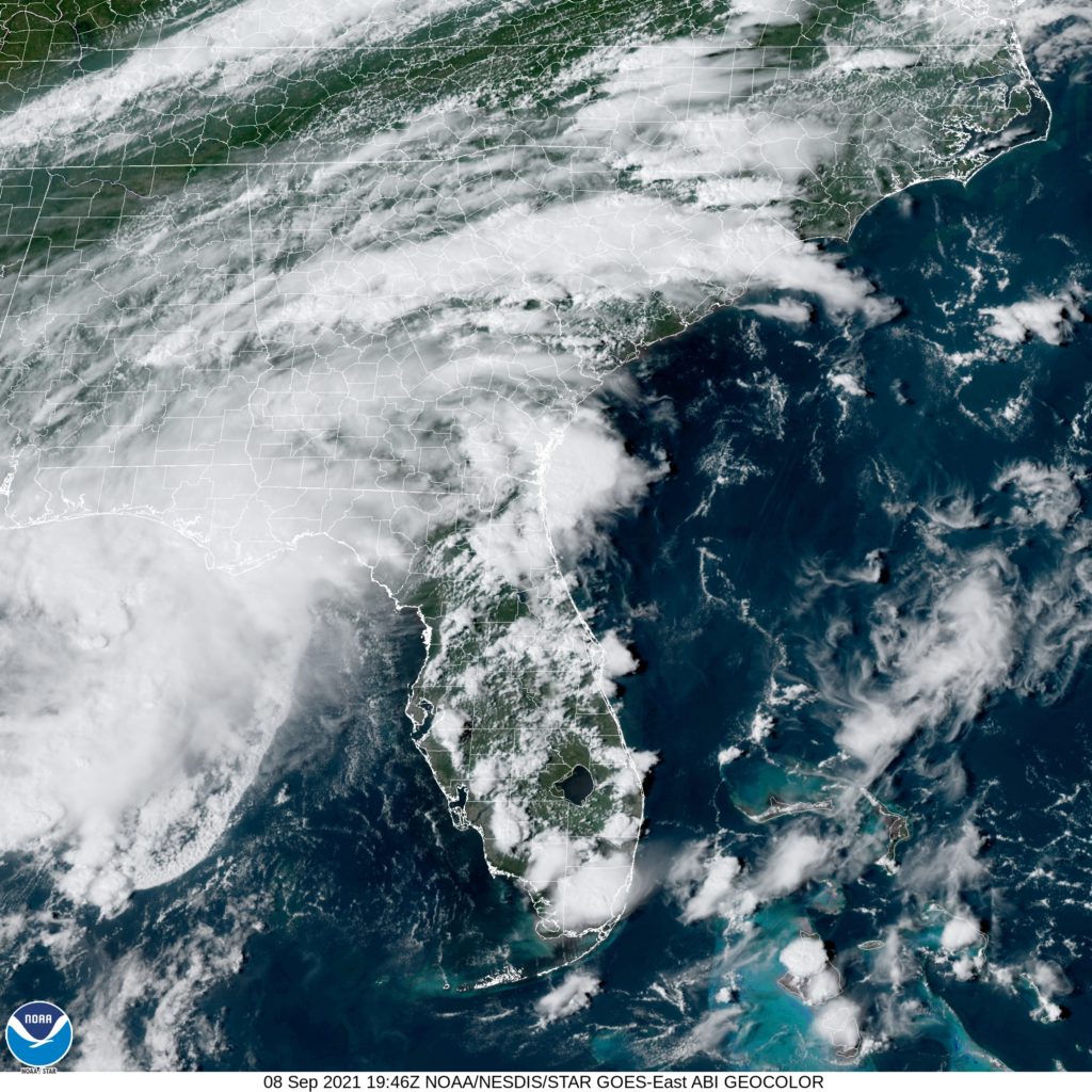
I think a lot o these forecasts are too cool for tomorrow. I don’t think it will be as rainy as many suspect, and it hit the 90s today. We shall see. Here is the local satellite, with low pressure in the northeast Gulf, and clouds ringing the peninsula.