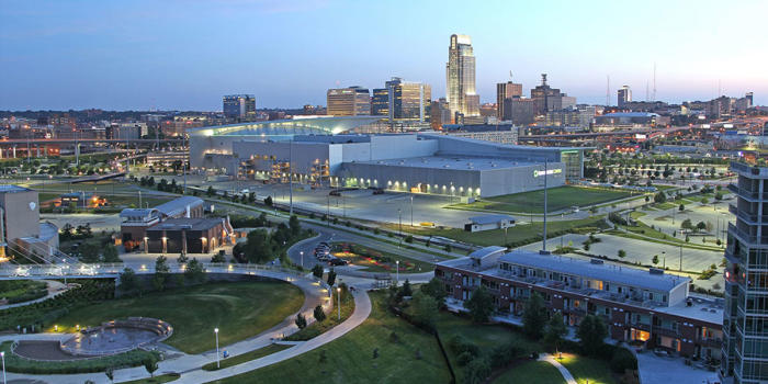
This road trip will be a little bit longer than our intra-Michigan trek yesterday, but it will still take only a day. We’ll cover 619 miles in just over 9 hours, as we skirt Chicago and pass through Des Moines into an underrated town. I think sometimes cities compensate for being in “boring” areas by being extremely interesting. Omaha is certainly interesting, and I would recommend a visit some day.
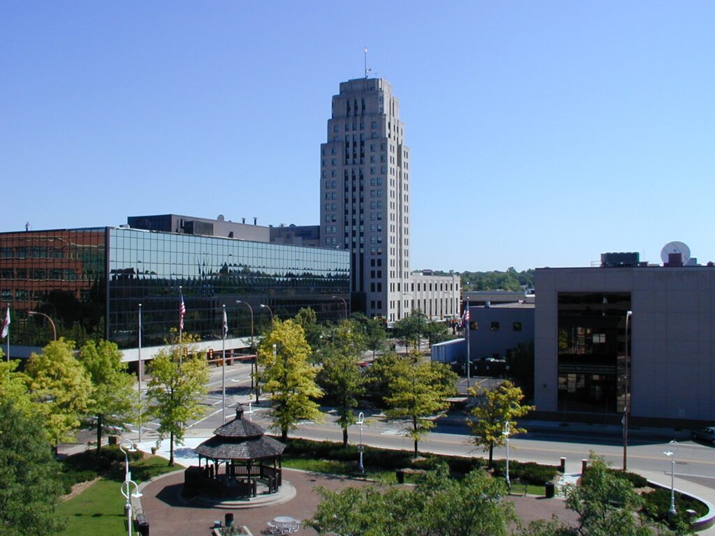
Battle Creek, Michigan
While today in Michigan is pretty nice (even though I got the road trip backwards! It was supposed to be Jackson to Battle Creek! I digress) there is a weak perturbation moving through the Upper Midwest that will change all that. Excepect some scattered showers and isolated thunderstorms to roll in to the area tomorrow evening, which means we will intercept on the way to Omaha. There will be a chance of these pop up showers – very few and far between – on the south side of Chicago, with the tail of the boundary stationary through southern Iowa. leading to scattered showers mostly south of I-80. Again, even if we see any rainshowers among the corn and Chicago traffic, they will be short lived. Potentially heavy, but short lived. Omaha is great, though, and shouild be drier than points eas.t.
It’s been a long, tough end to the cold season in the Upper Midwest for fans of warmer conditions. May started with more bad news for sunbathers of Omaha. After a storm system dipped south of Nebraska’s largest town, the clear air never forced its way in. Instead, the cold air behind the system settled in, and there was no way to heat it up, thanks to a persistent layer of clouds that lasted through the forecast period. Generally speaking, forecast outlets were more optimistic than what the situation called for. Weatherbug tends to have the chilliest forecasts, and the weather in Omaha played to their advantage on this occasion. Actuals: Tuesday, .06″ of rain, High 53, Low 41 Wednesday – High 54, Low 48
Omaha seems an interesting place to forecast for, given recent outlooks for the region. While today, the severe threat is to the south, if it stays there remains to be seen.
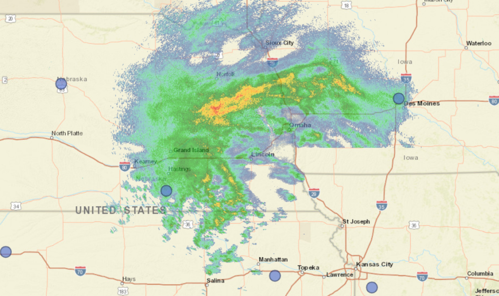
At 252PM, CT, Omaha was reporting cloudy skies with light rain with a temperature of 44 degrees. Brisk easterly winds persisted throughout the region, and worked mostly to hold the heaviest rain at bay, at least for the time being. A band of persistent rain showed on radar from Denison, Iowa to Columbus, Nebraska, and would eventually sink through Omaha tonight, A short wave moving through the central Plains had sunk closer to Kansas City, and the coldest, wettest shot was moving through the Omaha region. This very same system is causing some wet snow in the western part of Nebraska, but it doesn’t seem like enough cold air will cycle far enough to the east for that to be an issue in Omaha before the precipitation wraps up. The short wave means this system is moving fairly quickly, even if the rain training across the region makes that seem counterintuitive. Things will dry out fairly abruptly overnight, with mostly cloudy skies by tomorrow morning. The next shortwave is already presenting itself in the Pacific Northwest, and will approach Omaha by mid week. Tuesday will largely be unseasonably cool but pleasant, while the next round will increase the clouds on Wednesday. An inverted trough could bring light rain to the region on Wednesday afternoon, with the full brunt of the feature waiting until Friday morning. Tomorrow – A bit of rain before sunrise, then clearing. High 61, Low 43 Wednesday- Clouds increase with a spot of rain late, High 62, Low 45
TWC: Tomorrow – Cloudy skies early, followed by partial clearing (early rain) High 60, Low 41 Wednesday – Cloudy. Slight chance of a rain shower. High 63, Low 41
AW: Tomorrow – Cool; cloudy in the morning, then clouds and sun in the afternoon (AM Rain) High 59, Low 41 Wednesday – Intervals of clouds and sunshine (PM rain) High 63, low 42
NWS: Tomorrow – Cloudy, then gradually becoming mostly sunny (Early rain), High 60, low 43 Wednesday – A 40 percent chance of showers after 1pm. Mostly cloudy, High 61, Low 44
WB: Tomorrow – Decreasing clouds, late rain, High 56, low 41 Wednesday – Mostly cloudy, a chance of showers in the afternoon. High 59, Low 44
WN: Tomorrow – Partly cloudy with isolated showers, high 60, low 42 Wednesday – Mostly cloudy with scattered showers, High 62, Low 42
FIO: Tomorrow – Rain overnight and in the morning.High 59, Low 41 Wednesday – Rain in the evening and overnight. High 62, Low 41
Happy 40th birthday to the Weather Channel! here is a look at the radar from the Omaha region. Very busy!
I think it’s ok that Victoria-Weather and a couple of other outlets left the mention of rain out of the forecast in Omaha for yesterday. There were only a couple of drops, and they all came in the 10 o’clock hour, after everyone should have been in bed anyway. I guess it doesn’t really work like that though, so we have to give credit to The Weather Channel and the resurgent Weatherbug, who tied atop the forecast, thanks in part to their dash of Monday precip. Actuals: Sunday – High 86, Low 64 Monday – Rain reported, not measured, High 82, Low 66