I have to believe that most football fans in Southeast Pennsylvania were happy with the way the Super Bowl turned out on Sunday. I bet they barely noticed in Lebanon that over a 10th of an inch of ice coated light snow through the region on Friday. Everyone, somehow, pegged the snow and ice, so it came down to the thermometer, where the differentiator was a warm day on Friday. Accuweather and WeatherBug took a share of the win. Actuals: Friday – High 41, Low 31 Saturday – .33 inches of liquid in snow and ice, High 32, Low 24
After so many long trips across the country, it’s so nice just to journey within one state. This Keystone State drive will last only a couple of hours and cover just 93 miles of rugged terrain. We are looking at a pace of only 42mph! Let’s roll on, I guess.
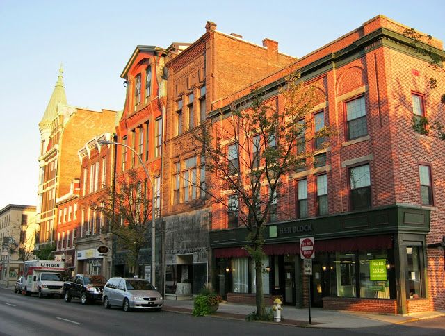
Lebanon, Pennsylvania
It’s currently snowing throughout out eastern Pennsylvania, which may lead to some lingering slick roadways, particularly the more lightly traveled and higher elevation roads. The precipitation will be wrapped up as we head out, but chilly wind with the fresh snow will make the drive, short that it may be, fairly challenging. Having a bit of sunshine will help, and the sun has a better chance of peeking out if we leave later in the day.
After some pretty disastrous forecasting results to start the year, I am hoping that a return to the eastern US will give our outlets a bit better fortune. Of course that only works if the weather is quiet. That doesn’t look to be the case…
At 955PM, ET, Lebanon was reporting a temperature of 35 degrees with fog. The entirety of southeastern Pennsylvania was blanketed by fog in the wake of a cold front that was reaching the South Jersey coast. Low pressure has shifted into New England, with clearing air behind the boundary. Tonight, however, the lingering low level moisture and cooling air is fostering the low visibility in the region. Friday will be brisk, but dry at the surface. With clearer skies tomorrow, expect the daily low at midnight, leading to Saturday. The strong seasonal jet is continuing to run west to east through the Ohio Valley into the mid Atlantic. The jet features many streaks, so even though the flow is laminar, redevelopment of surface features is ongoing. Low pressure will reemerge in the Plains and start lifting a warm front towards Lebanon by Saturday afternoon. Some wet snow may fall initially, but it will be followed by an icy mix. Tomorrow – Mostly sunny, High 37, low 26 Saturday – Snow starts in the afternoon, and turns to a wintry mix. High 34, Low 22
TWC Tomorrow – Intervals of clouds and sunshine. High 38, Low 24 Saturday – Cloudy. Snow showers developing in the afternoon High 34, Low 21
AW: Tomorrow – Sunny to partly cloudy and windy; High 39, Low 26 Saturday – Cloudy with a coating to an inch of snow and sleet late in the afternoon; deteriorating travel conditions at nigh High 36, Low 23
NWS: Tomorrow – Mostly sunny, High 35, Low 26 Saturday – A chance of snow before 4pm, then a chance of snow and sleet. Mostly cloudy, High 35, Low 22
WB: Tomorrow – Mostly sunny, High 37, Low 26 Saturday – Mostly cloudy, a chance of snow, freezing rain an sleet in the afternoon, High 34, Low 25
WN: Tomorrow – Partly cloudy, High 34, Low 26 Saturday – Mostly cloudy with a chance of sleet/snow High 35, Low 23
CLI: Tomorrow – Partly cloudy, High 37, Low 22 Saturday – Blowing snow, High 38, Low 20
The system that left the fog left ice this morning. Sub optimal to be expecting it again so soon.
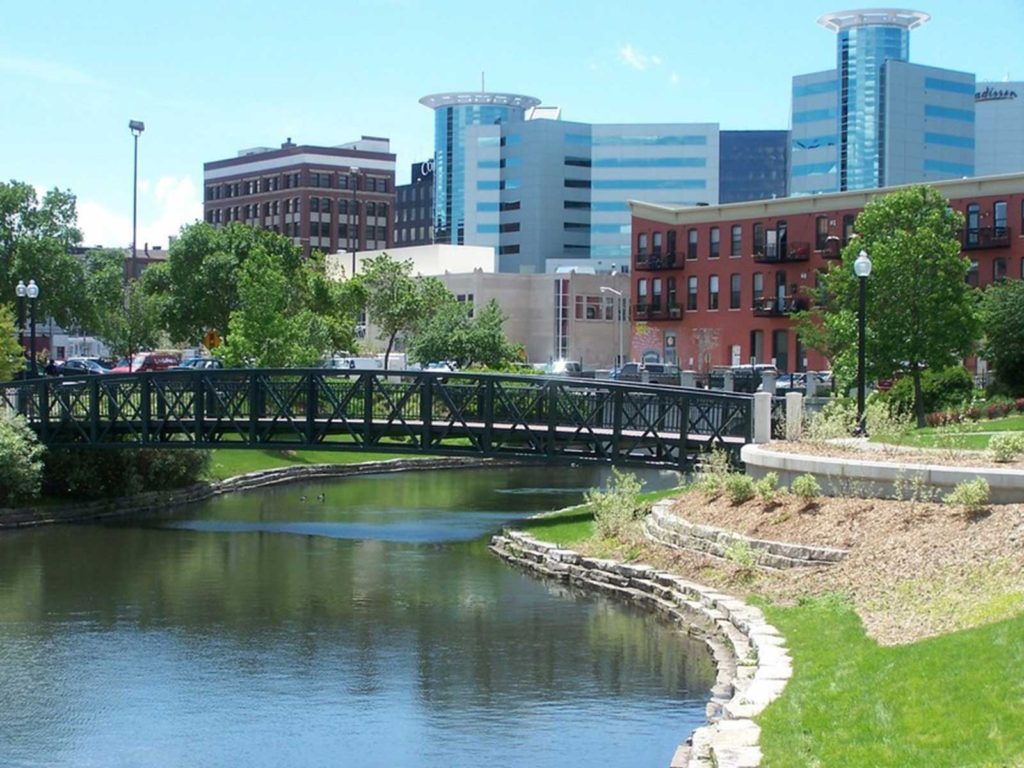
It seems like these two towns are far apart, at least in my brain, and I suppose they are. It’s a 603 mile drive, lasting for one long day. We’ll set a pace of 64.2mph, thanked, in no doubt, by the fast drivers of Michigan.
Lebanon, Pennsylvania
Low pressure is still spinning over the St. Lawrence Seaway, and it doesn’t look like it will be motivated to move before we are ready to travel tomorrow. Fortunately, isn’t going to be rich with moisture, and we will be in the car, able to avoid the cooler air the low pressure brings in. Some of the flow coming off the lakes could lead to some clouds and fog on the western faces of the Appalachians of central and western Pennsylvania. Mostly cloudy skies will continue through Ohio and Michigan, but they won’t scrape the surface like they could in Pennsylvania. Kalamazoo will be cloudy and seasonably cool tomorrow evening, but a turn around is around the corner.
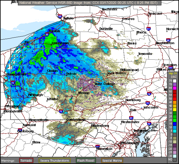
Well, this has certainly been an interesting week. The weather continues apace, regardless of the virus that is gripping society. Let’s check out southeastern PA.
At 856PM, ET, Lebanon was reporting a temperature of 47 degrees with overcast skies. There was overcast across the region with light return showing up on radar across central Pennsylvania, though there weren’t any precipitation reports from reporting stations east of Pittsburgh. The band of precipitation is the tail front attached to low pressure moving through Hudson Bay. A shallow jet trough covers northeastern Canada, and is sort of the second step of a two step jet stream. Ultimately, there is a ridge over the eastern part of the country, which is helping to mitigate the threat of precipitation, but will also allow some clearing tomorrow afternoon. The lower step of the jet is going to continue to translate eastward and with it, the next round of wet weather. A warm front, laden with fairly heavy rain and potentially an isolated thunderstorm will arrive late in the evening on Wednesday. Tomorrow – A little bit of early rain, High 55, Low 43 Wednesday – Mostly sunny with increasing clouds and a late shower or thunderstorm, High 55, Low 35
TWC: Tomorrow – Rain showers early with overcast skies later in the day. High 57, Low 38 Wednesday – Partly cloudy skies in the morning will give way to cloudy skies during the afternoon (late rain). High 57, Low 32
AW: Tomorrow – A passing shower or two in the morning; otherwise, clouds giving way to some sun High 57, Low 31 Wednesday – Increasing clouds (late rain) High 57, Low 31
NWS: Tomorrow – A chance of light rain, mainly before 10am. Cloudy High 57, Low 3- Wednesday – Sunny (late rain), High 56, Low 33
WB: Tomorrow – Cloudy, a chance of light rain in the morning, High 57, Low 40 Wednesday – Sunny (Late rain), High 56, Low 35
WN: Tomorrow – Mostly cloudy with scattered showers, High 57, Low 40 Wednesday – Mostly sunny, High 56, Low 33
FIO: Tomorrow – Possible drizzle in the morning. High 57, Low 38 Wednesday – Partly cloudy throughout the day. High 58, Low 31
It looks like we are visiting Lebanon right between two bouts of rain. What timing! Maybe things are looking up.