Was our forecast for Kennewick the worst we have ever done? No, I wouldn’t say that. This is a solid D effort all around, and consistently so, across the board. D- though. Ahead of a cold front, upslope flow socked Kennewick in last Monday, keeping temperatures nestled in the mid to upper 30s, with nary a chance to escape. Then, when the front came, to the shock of all participants, the moisture did “traverse the Cascades” and brought a little bit of light rain to the area. When the cloud cover cleared, and the sun came out on Tuesday, all while the upslope turned to downslope, temperatures were even allowed to leap all the way into the mid 50s, which is not what anyone had in mind. The top forecast was issued by the trio of The Weather Channel, Weatherbug and Forecast.io, but everyone was within 2 points of one another. That isn’t a good thing. Actuals: Monday – High 38, Low 36 Tuesday 06 inches of rain, High 55, Low 31
The western US tends to get left behind in the weather coverage, unless it’s fire season. That has changed in the past couple of weeks, with the so called atmospheric river emptying on the Pacific Northwest. Are more headlines in the future?
At 706PM, PT, Kennewick was reporting mostly cloudy skies with a temperature of 33 degrees. The overcast was thanks to a bit of upslope on the eastern exposure of the Cascades, with flow being drawn northward towards the latest system which has arrived over British Columbia. The Pacific Northwest is in the warm sector of this feature, and if the clouds erode early tomorrow, things should warm up decently tomorrow in Kennewick. The low will move northward, and delay the arrival of the associated cold front. Kennewick may be cloudy tomorrow morning, but ultimately it will be dry tomorrow. The front will arrive Monday evening on the coast, but moisture will fail to traverse the Cascades. There will be a warm up ahead of the arrival, even without any frontal passage, at least not until Tuesday. Tomorrow – Cloudy early, becoming sunnier, High 40, Low 30 Monday – Sunnier and a bit warmer, High 43, Low 28
TWC: Tomorrow – Mostly cloudy skies. High 41, Low 29 Monday – Some clouds in the morning will give way to mainly sunny skies for the afternoon. High 45, Low 29
AW: Tomorrow – Partly sunny High 38, Low 28 Monday – Partly sunny; quiet weather for early holiday travelers High 42, Low 28
NWS: Tomorrow – Patchy fog before 10am. Otherwise, mostly cloudy High 40, Low 30 Monday – Patchy fog before 10am. Patchy freezing fog before 7am High 42, Low 29
WB: Tomorrow – Partly sunny. Areas of freezing fog and patchy fog in the morning, High 39, Low 30 Monday – Partly sunny, areas of fog and patchy freezing fog, High 42, Low 29
WN: Tomorrow – Mostly cloudy, High 40, Low 30 Monday – Partly cloudy, High 42, Low 29
FIO: Tomorrow – Mostly cloudy throughout the day. High 41, Low 31 Monday – Partly cloudy throughout the day. High 44, Low 28
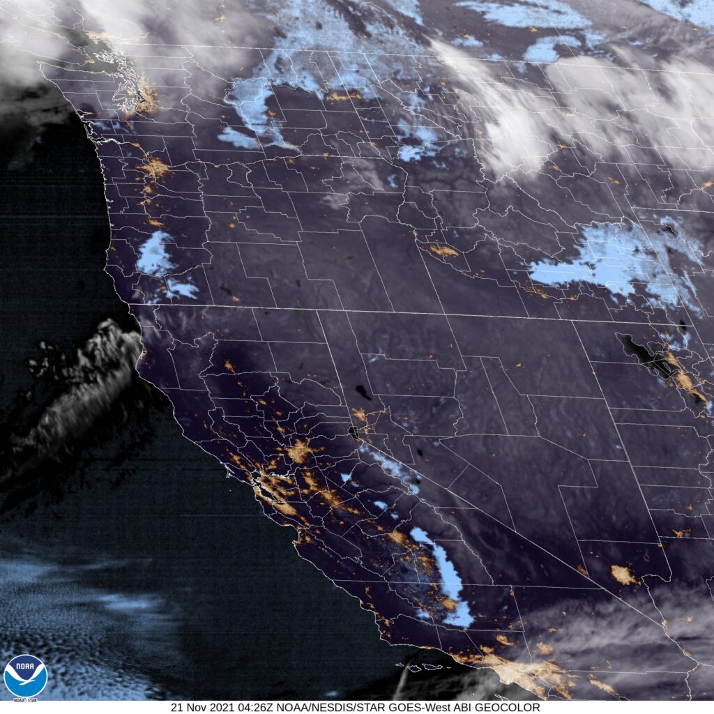
Between kids that don’t want to sleep tonight and just general attenton span issues, it took 4 hours to write this bad boy. Yikes. Here is the imagery of the region. Look at how narrow the patch of clouds is in south central Washington, just enough to mess with Kennewick.
What a lovely, winding mountain drive we get to take this week, running from Fort Collins to Kennewick. It will take two mountain filled days to get from Colorado to Washington, covering a road distance of 1035 miles. This will mean a pace of 67.7mph, thanks to a route that eschews large population centers. The first day will be longer, and will cover 541 miles of the interior west, leaving a shorter day to enjoy the scenery in the Pacific Northwest.
DAY ONE (Friday)
Fort Collins, Colorado
The two most magical words to any road tripper concerned about the weather are going to apply to our Friday drive. “High Pressure” It will be pleasant and seasonably warm as we hit 4 states on Friday. Most of the time will be spent in Wyoming, a considerable amount in Utah, with our endpoints starting in Colorado and Idaho. You will be able to see for miles in Juniper, Idaho, in the southern part of the state, and the destination for our first day of travel.
DAY TWO (Saturday) Low pressure arriving from the Gulf of Mexico will not be as cooperative as the high pressure from Friday. Not much precipitation often finds its way inland, so we won’t see heavy precipitation, but we will certainly see some rain between Caldwell, Idaho, a western suburb of Boise, and La Grande in northeast Oregon. Subsident air on the lee side of the Cascades will clear things up for us once again as we arrive in Kennewick. It will probably be clearer and a little more crisp, but what else do you want in the high terrain?
Are you ready for a lengthy trek cross country? We are heading from the northwesternmost state in the land to the eastern part of North Carolina, and will take us 5 days to make that trip. This is the perfect summer road trip, if you ask me. The mileage will hit 2810 miles, for a pace of about 67mph, with the first 4 days ending after about 535 miles, with a 10 hour day coming on Sunday. Let’s get to North Carolina by the end of the weekend, shall we?
DAY ONE (Wednesday)
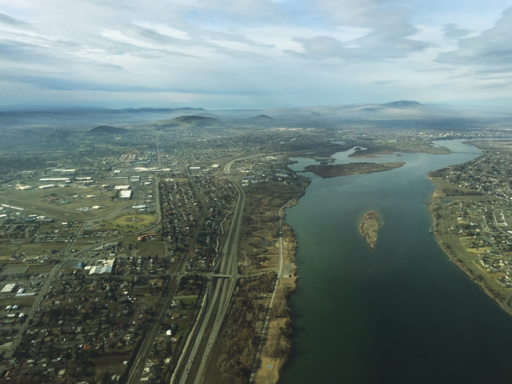
Kennewick, Washington
Sometimes, in the eastern-US focused weather community, we forget that in the summer, that constant thunderstorm threat we are used to just doesn’t exist for a big part of the early summer. Such is the case this week in the Pacific Northwest. Quiet weather will allow us to take in the scenery from Washington, through Oregon and Idaho until we reach Howell, in the Utah panhandle.
DAY TWO (Thursday) The seasonal monsoon is preparing to develop in the southern Rockies, and indeed some guidance is pointing towards thunderstorms in the Colorado Rockies. Fortunately, we will not be traversing the Colorado Rockies, instead passing through Wyoming before ending up in Bushnell, in far western Nebraska. Rain is not expected to obscure our day.
DAY THREE (Friday) Nebraska us a long, arduous state to pass through by car, but if you like driving and identifiable benchmarks, then Nebraska is for you. We’re headed off the road for Nebraska City, then south through Iowa and Missouri, where we will stop in St. Joseph. Nebraska is going to be in fine shape. Lingering humidity will likely lead to morning fog, that I would hope will burn off by the time we reach St. Joseph.
DAY FOUR (Saturday) A slow moving, lingering trough extending into the Ohio Valley will make things a bit drearier on Saturday. By the time we reach southern Illinois, clouds with a stray sprinkle will become increasingly likely, with a rogue stroke of lightning not out of the questions. This will continue eastward, as we call it a day in Carefree, Indiana, which is west of Louisville.
DAY FIVE (Sunday) It’s just the time of year, but more wet weather will be possible on either side of the Appalachian range, but with low pressure developing in the Great Lakes, the better chance for rain or even a rogue thunderstorm will come up in eastern Kentucky and before we reach Charleston in West Virginia. There will be a healthy rain shadow in North Carolina, but we are headed far enough east, some oceanic flow will lead to isolated storms along the coast, including in Greenville, as we arrive, exhausted, at the end of our long day, at the end of our long trip.