Last week, we took a look at Corpus Christi, where a weak area of low pressure was developing along the Mexican border. The only real problem I had with it was that the rain associated with it came heavier and harder about a full day early. At least by my estimation, because the rest of the group seemed to get it right. Nobody got it right-er than The Weather Channel, who also handled a Monday that was cooler than expected. Actuals: Monday – .57 inches of rain, High 79, Low 68 Tuesday .07 inches of rain, High 84, Low 75
The only part of the Gulf Coast I’ve ever visited is in South Florida. this two day trek will sweep along the whole doggone thing. It’s a 1071 mile journey which will be paced at 68.5mph, despite travel through Atlanta and Houston’s sprawling suburbia. There will be a little bit more to day one, as we expect to cover 548 miles, leaving the rest for Wednesday.
Athens, Georgia
DAY ONE (Tuesday) It’s not a sight we see too often from May to about October. There will be a solid area of high pressure camping in the region today and tomorrow. This is great because tomorrow, we are driving through the southeastern US! We’ll navigate Atlanta and Montgomery with no weather issues, making it to Robert, Louisiana on the northwest side of Lake Pontchartrain to finish off our day.
DAY TWO (Wednesday) One of the busiest stretches of the Gulf Coast, weather-wise, is the patch between Houston and Lake Charles. Indeed again, we may see some storms starting to pop up in this area, particularly in the Beaumont area, but by the time we get through Houston, we should have nothing but sweltering highway ahead of us. A cold front is moving through north Texas, drawing that moisture in through Beaumont, but the relief will come much later to Corpus Christi.
Whenever we can talk about inclement weather in the Plains, that usually means a steady threat of showers somewhere along the Gulf Coast. Is that place Corpus Christi for the next couple of days?
At 1051PM, CT, Corpus Christi was reporting a temperature if 75 degrees with mostly cloudy skies. There was smattering of clouds along the coast reflecting an onshore flow feeding thunderstorms along the dryline over west Texas. While there is indeed a strong system in the northern Plains, the threat of thunderstorms in the southern Plains was tied to the dry line, and is not going to move much further to the east. There isn’t a lot of upper level dynamics at work in the southeastern US, but guidance is pinging on a surface low developing near Del Rio on Tuesday morning. This will tap into the return flow suppling showers further north, and begin to follow the same course. This will mean heavier showers and storms over the Corpus Christi region on Tuesday. It will be forced to oblivion as a stronger feature develops along the Colorado-New Mexico border. Tomorrow – Mostly cloudy, High 85, Low 73 Tuesday — Showers and storms, especially early, High 83, Low 75
TWC: Tomorrow – Variable clouds with thunderstorms, especially in the afternoon. High 83, Low 73 Tuesday – Thunderstorms likely, especially in the morning…and becoming windy High 84, Low 74
AW: Tomorrow – A shower in the morning, then a few strong t-storms; storms can bring flooding and damaging winds High 84, Low 71 Tuesday – Mostly cloudy; a shower or thunderstorm around, breezy and humid High 84, Low 72
NWS: Tomorrow – Showers and thunderstorms likely, mainly after 1pm. Cloudy High 83, Low 75 Tuesday – A 40 percent chance of showers and thunderstorms. Mostly cloudy High 85, Low 75
WB: Tomorrow – Mostly cloudy. A slight chance of showers and thunderstorms in the morning, then a chance of showers and thunderstorms in the afternoon. High 82, Low 76 Tuesday – Mostly cloudy with a 40 percent chance of thunderstorms, High 82, Low 76
FIO: Tomorrow – Mostly cloudy with scattered storms, High 84, Low 74 Tuesday – Mostly cloudy with scattered storms, High 85, Low 75
FIO: Tomorrow – Light rain in the afternoon. High 82, Low 74 Tuesday – Rain starting overnight, continuing until morning. High 83, Low 76
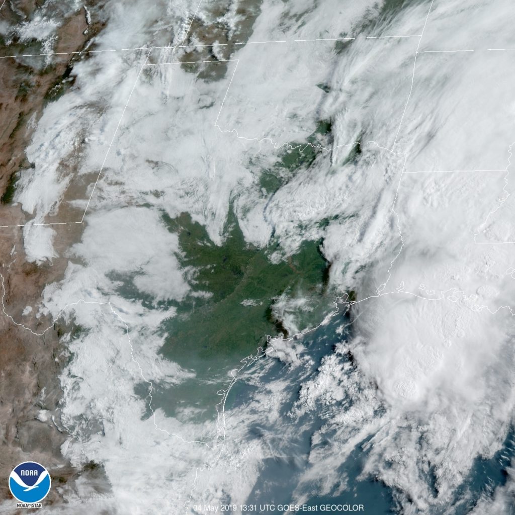
Here is the satellite, with interior Texas looking clear, but a line of storms near the Big Bend.