It’s been a rainy week for the mid-Atantic and New England, but for the middle of the week, Barnstable and the Cape saw a bit of of a reprieve. It was cooler than one might expect, but the end of rain and increased sunshine on Wednesday overcame the onshore breezes, and it actually started to warm up, even hitting 60 in the afternoon. That kind of optimism is Victoria-Weather’s wheelhouse, giving us a victory on the day. Actuals: Tuesday – High 59, Low 41 Wednesday – High 60, Low 36
This is going to be a an East Coast road trip through a part of the country that probably isn’t keen on travelers right now. Let’s make sure that we mind our P’s and Q’s while trekking through the busiest parts of the country on our full day’s drive,
which will cover 477 miles. Our pace will be 62.2mph, which is probably a little faster than normal, because of everything going on.
Washington DC
Brr! The last coldest shot of spring is moving into the mid-Atlantic tomorrow, and we will drive through those big cities, like Philadelphia, New York and Baltimore with the windows up. The sun will be out, so we won’t need the heat, and by the afternoon, it tends to get warm in the car, but it will be that difficult blend of too hot in the car because of the sun, and too cold to leave the windows down. But at least we will be able to avoid anything more serious than a stiff breeze, and will end up in Barnstable, which is nice.
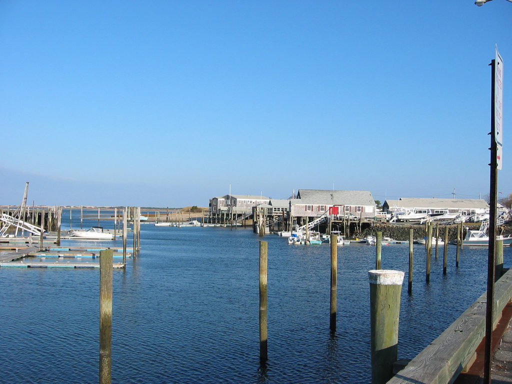
i hate to do this as we all have our plans and lives suspended, but our forecast schedule is taking us to a great vacation town, Barnstable, which is on Cape Cod.
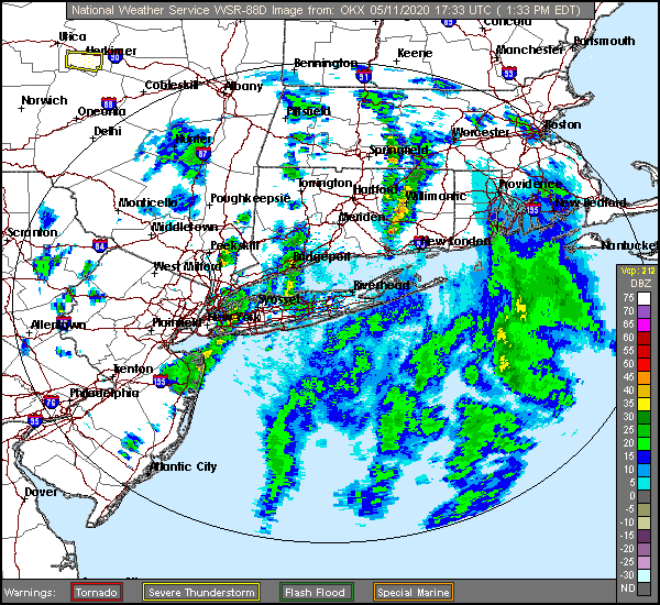
At 156PM, ET, Barnstable was reporting a temperature of 56 degrees with clear skies. This is a little misleading, however, as an area of low pressure moving through New England is generating bands of rain showers through the region, with a looming band approaching Martha’s Vineyard, with rain reported as close as Newport, Rhode Island and Plymouth, Massachusetts. This is the occluded portion of the evolved area of low pressure, and short term changes won’t be substantial ater this leading round of rain moves through. After the low moves through, a pocket of cold air will invade and make for a chilly Tuesday. The circulation surrounding the low as it moves into Maritime Canada will bring some flurries to the Adirondacks, and breezes will be stiff on the Cape. Wednesday looks like a more pleasant day, with wind subsiding and warm air encroaching from the southwest. Tomorrow – Passing clouds with breeze, High 57, Low 42 Wednesday – Chilly in the morning, but sunny in the afternoon, High 57, Low 36
TWC: Tomorrow – Generally sunny despite a few afternoon clouds. High 58, Low 44 Wednesday – Except for a few afternoon clouds, mainly sunny. High 57, Low 49
AW: Tomorrow – Mostly sunny and breezy High 58, Low 44 Wednesday – Plenty of sun High 57, Low 40
NWS: Tomorrow – Mostly sunny, High 57, Low 43 Wednesday – Sunny, High 57, Low 38
WB: Tomorrow – Sunny, High 56, Low 44 Wednesday – Sunny, High 55, Low 38
WN: Tomorrow – Mostly sunny, High 56, Low 44 Wednesday – Mostly sunny, High 57, Low 38
FIO: Tomorrow – Clear throughout the day. High 56, Low 44 Wednesday – Clear throughout the day. High 56, Low 40
The tough part about temperature forecasting in Barnstable is that you need to closely monitor the wind direction and speed. Brisk off shore winds will keep it a bit warmer on Tuesday, and light on shore winds will keep it cooler on Wednesday. The radar comes from Long Island, as Boston’s is out today.