A lot of the attention for the week, including on this site, has revolved around the eclipse and whether or not we will be able to view it, even if we are in the axis of totality. The story for the rest of the week will follow a lot of the same territory, but will instead surround the threat for tornadoes and other severe weather.
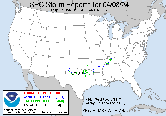
A sharp upper level trough is moved into the Plains yesterday and isn’t really related to the inclement weather obscuring the sky during the eclipse. As it moved in, surface low pressure attempted to organize in west Texas that afternoon and evening. While access to moisture was be limited, access to potential energy was not.
In a scenario like this, you might see some “LP” or Low Precipitation supercells, which are the type that produce the photogenic tornadoes moving through open fields that you see in textbooks. The feature didn’t have enough tight circulation to introduce a bunch of tornadoes, but the updrafts were there, and even without much rain falling, we saw some jumbo sized hail.
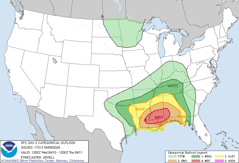
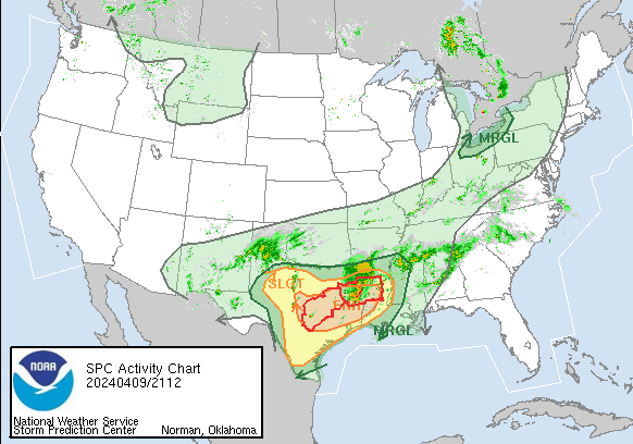
It will be more of the same today, but with the bullseye shifted to east Texas and western Louisiana. Additionally, the threat for tornadoes, though perhaps not gigantic twisters, will increase in this area as the low gets more focused and better moisture. We can see with the SPC activity loop that there are a couple of watches out already, and the threat for severe weather today is increasing
This negative trend will continue through the heart of Dixie Alley on Wednesday, with tornadoes and strong winds possible through Mississippi, and again on Thursday in Alabama, Georgia and north Florida. Especially by tomorrow, the ingredients will be perfectly meshed for a potentially high end severe weather event. There is a chance to see a major tornado outbreak in the moderate risk region for severe weather outlook, which include Baton Rouge, Jackson and the parts of Dixie Alley that are far too accustomed to this kind of weather.