
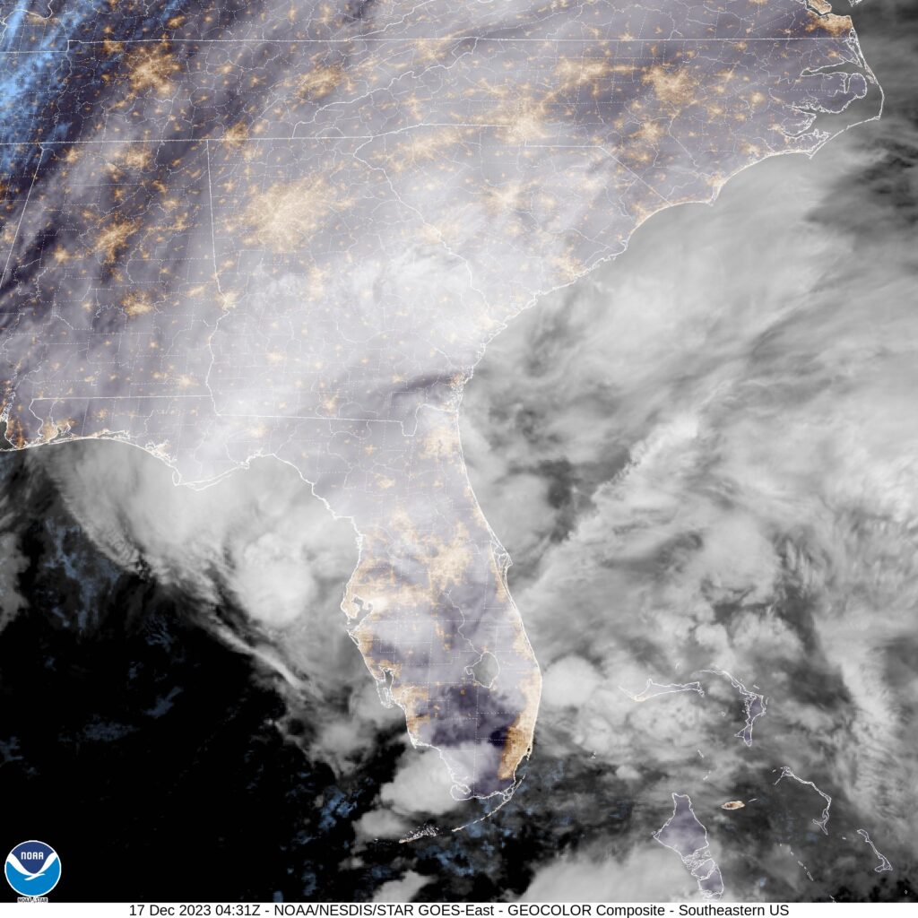
A strong area of low pressure is coming out of the Gulf of Mexico is presently leading to a slight risk of severe weather across the Florida, with wind and tornadoes possible in the Sunshine State overnight tonight. The storm will cross north Florida overnight tonight and track into the Carolina Plains by the end of the day tomorrow.
The storm will continue northward, with the center of the storm moving north through the Hudson River Valley on Monday morning, eventually arriving in Canada by nightfall. Storms will be possible tonight in Florida, as I noted, and along the Carolina coast tomorrow, with the severe threat winding down as the system smashes New York and New England.
One thing to note is the track of the storm. With these coastal storms, the warm side is to the east, the cold to the west. With the center of the storm expected to pass over New York and head northward, the entirety of New England will be in the warm sector for the storm until the heaviest of the precipitation is through. This is going to be a wind and rain event for the largest population centers.
Without a deep cold trough, the heavily accumulating snow is going to come for the Appalachians and down stream from Lake Erie. This snow will also wait until after the main thrust of the season is in the Maritimes, and will be related to the post system flow from the northwest.
The last work week of 2023 is going to be fairly unpleasant for a lot of people, and will slow down travel plans, but it could be worse. This is a strong fall like system, and not a true winter nor’easter. While travel will be slowed, it will bounce back quickly with plenty of time for the holiday.