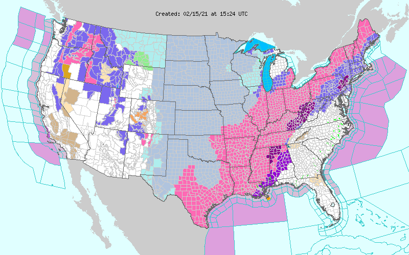
If you live pretty much anywhere in the continental United States, the story leading the local news probably revolves around the hellish winter conditions in your area. What you might not fully appreciate is that it’s rough everywhere in the country, save, perhaps, for the desert Southwest, though even there, there are some winter weather advisories around the 4 Corners.
In the Pacific Northwest, a large system brought significant snowfall not only to the Cascades, but closer to the coast, where Seattle was even placed in the grips of heavy wet snow before things could finally turn to rain yesterday. The storm has lost a lot of it’s organizational structure at the surface, but it continues to bring snow to the mountains of the northern and central Rockies.
Eventually, this system will be the feature praised for breaking the vicious cold snap that has been keeping everyone indoors and by the fire across the Plains. Record breaking cold has come to the far northern Plains, but also subzero temperatures are sinking as far south as Oklahoma. A wind chill advisory was issued for the Houston for the first time ever.
If you are in Houston, however, the cold is only part of the problem. East Texas remains in a winter storm warning, and are also seeing temperatures much colder than they are accustomed to, including parts of the state that are 50-60 degrees colder than normal. Snow and freezing rain blasted the state this weekend, with places as far south as Austin receiving half a foot of snow, and Brownsville and Harlingen seeing a dusting of snow.
A huge part of the issue, however, is the burden on energy in Texas. There are infrastructural issues with preserving power systems in the cold, there are also functional problems. Texas doesn’t rely on natural gas for heat like a lot of places in the north, with many houses not even having furnaces. As a result, the electrical grid is overwhelmed by the widespread use of space heaters, and millions of Texans are out of power.
Now, the system, as you might be able to discern from the warnings at the top of the page, is heading to the northeast, where it will be enhanced by the Great Lakes from Indiana to New England, but where the storm will really be dangerous is on the southern and eastern flank, from the Tennessee Valley to southern New England, where a significant ice storm is expected through the next 24-36 hours. In fact, the threat for freezing rain has started on the Gulf Coast last night, and continues to the north today.
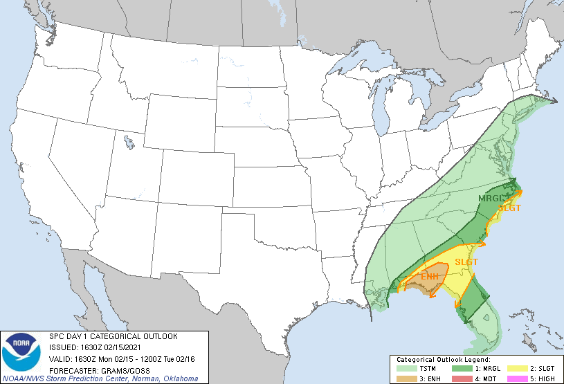
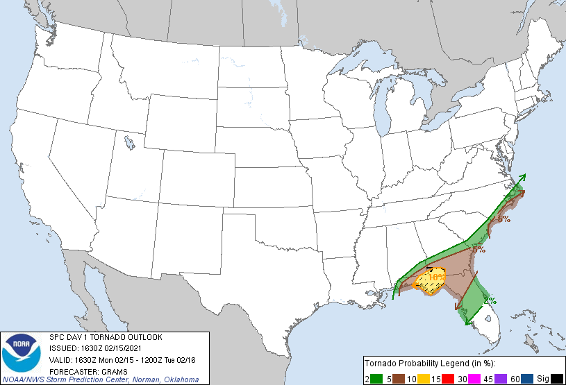
The cold, snowy weather will not sweep into the southeastern United States, but the clashing of the record cold air mass with the typically temperate weather of the southeast will bring about a threat for severe weather.

There is even a high risk for tornadoes west of Tallahassee, with some concern for large, destructive tornadoes.

Winter is kicking our butt right now, America. Hopefully, we will get out of it by the end of the month.
