Tonight we head to the Southern Plains to see how Tulsa is setting up for the rest of the workweek. Will the Golden Hurricanes of the namesake university see a peaceful couple of days? Or is there a tempest brewing?
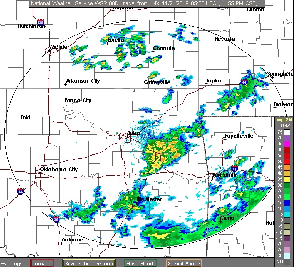
At 1053pm CST, the temperature at Tulsa, OK was 63 degrees under partly cloudy skies. An area of low pressure is working through the Midwest, trailing a cold front through the Southern Plains that will bring rain showers and a few scattered thunderstorms during the day. However, temperatures will be falling throughout the day as cooler air works in from the morning as high pressure works down into the Northern Plains. As the boundary continues to push south Thursday into Friday morning, a few lingering rain showers are anticipated over the region, though the heaviest activity looks to be off to the east. Conditions should dry up as the day goes on, but even cooler temps will work their way into the state as high pressure pushes further south over the Central Plains.
Thursday: Chances of showers and thunderstorms. High 62, Low 42.
Friday: Widespread showers. High 41, Low 34.
TWC: Thursday: Rain. High 65, Low 44.
Friday: Showers. High 44, Low 34.
AW: Thursday: A shower in the morning. High 65, Low 45.
Friday: Occasional morning rain. High 44, Low 35.
NWS: Thursday: Chance of showers then thunderstorms. High 63, Low 45.
Friday: Showers then chance of thunderstorms. High 45, Low 36.
WB: Thursday: Rain showers expected. High 63, Low 45.
Friday: Morning rain showers. High 45, Low 35.
WN: Thursday: Mostly cloudy with isolated storms. High 63, Low 45.
Friday: Mostly cloudy with scattered showers. High 44, Low 37.
FIO: Thursday: Light rain starting later tonight. High 66, Low 44.
Friday: Possible light rain until afternoon. High 45, Low 36.
Some decent rain showers are found east of the city and pushing towards Joplin. Another couple rounds of precip are in the cards for the rest of the workweek however.

