May started off so good in Worcester. By the end of May 3rd, however, rain had moved in and started a cool stretch that would leave the state below normal for an extended period to time. The third was towards the warm end of forecasts, but the 4th, a significantly rainier period, was on the colder side. The Weather Channel navigated to the best forecast, which significantly outpaced a couple outlets, who didn’t have rain forecast for the 4th at all. Actuals: May 3rd, .03 inches of rain, High 68, Low 51 May 4th, .61 inches of rain, High 56, Loe 46
I’m not sure there is a town with more unpronounced letters than Worcester, especially by the local population.
At 1254AM, ET, Worcester was reporting overcast skies with a temperature of 53 degrees. The tail of a weak cold front tailed through the Cape and south of Massachusetts, kicking up an interesting radar return over Boston Harbor, with gravity waves rippling through Massachusetts Bay. It looks quiet over most of New England overnight, though, as the system resposnible for the front is otherwise sequestered over Labrador, and will not cause further problems for Massachusetts. The next feature is already knocking on the door in the Northeast. Rain will move in from the south, reaching Worcester as early as the early afternoon on Monday. Rain will continue and begin to intensify later in the evening. A warm front might bring an isolated thunderstorm overnight Monday to Tuesday, as the boundary passes The warm sector of the system will linger over southern New England through most of the daylight hours, but more rain will arrive late in the evening as the parent low approaches. Tomorrow – After noon rain, intensifying late with a rumble of thunder. High 62, Low 50 Tuesday – Early rain, mostly sunny, then rain returns late, High 53, Low 44
TWC: Tomorrow – Cloudy. Late rain High 67, Low 52 Tuesday – Cloudy with occasional rain.. High 54, Low 48
AW: Tomorrow – Mainly cloudy with a passing shower this afternoon High 68, Low 53 Tuesday – A brief shower in the morning; otherwise, low clouds, then perhaps some sun High 58, Low 49
NWS: Tomorrow – Mostly cloudy High 65, Low 52 Tuesday – Showers likely, mainly before 9am. High 63, Low 49
WB: Tomorrow – Mostly cloudy (evening rain), High 63, Low 53 Tuesday – Mostly cloudy with 50 percent chance of showers, High 53, Low 48
WN: Tomorrow – Mostly cloudy, High 65, Low 53 Tuesday – Mostly cloudy with showers likely High 63, Low 49
FIO: Tomorrow – Possible light rain in the evening. High 71, Low 51 Tuesday – Rain overnight and in the morning. High 53, Low 45
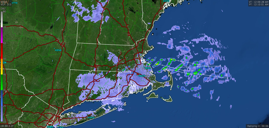
I think temperature forecasts have a high bust potential, given the proximity of low pressure to our forecast site. We will find out in a few days. Check out this neat looking radar image from the Boston area, with the radiating bands of rain showers, away from Boston.
We’re looking at a pretty active week in New England, and it ended with a bit of inclement weather last week as well. Anarea of low pressure slashed through New England and brought wind and rain to the region on Thursday and Friday, including in Worcester, where we had stopped in for a forecast. Things remained much cooler than in the forecast as a slow moving cold front proved inhibiting to solar radiation. Victoria-Weather was one of the handful of outlets that correctly called for rain (and they got .14″ which isn’t anything to sneeze at) and we also happened to be on the cool side of forecasters. Those two factors were enough to secure victory. Actuals: Thursday, High 50, Low 25 Friday – .14 inches of rain, High 51, Low 38
Wow! Another forecast! And every single part of this city name is really tough to spell!
AT 354PM, ET, Worcester was reporting a temperature of 42 with fair skies. there were a few stray clouds across New England, but high pressure over the region ensures that they won’t amount to much. The ridge is angled north and south along he Appalachians, and will be easily moved by a cold font appended to a deep area of low pressure over Hudson Bay. The boundary will sweep in fairly early in the day on Friday, leaving a low overcast day marked by a bit of light rain throughout the day. Tomorrow – Mostly sunny, High 48, Low 26 Friday – Overcast with rain at times, High 54, Low 36
TWC: Tomorrow – Generally sunny despite a few afternoon clouds. High 51, Low 28 Friday Cloudy (early rain).,High 59, Low 39
AW: Tomorrow – Sunshine mixing with some clouds High 50, Low 27 Friday – Variable cloudiness High 56, Low 38
NWS: Tomorrow – Sunny, High 51, Low 28 Friday – A slight chance of showers after 1pm. Mostly cloudy, High 58, Low 39
WB: Tomorrow – Sunny, High 49, Low 27 Friday – Mostly cloudy, High 7, Low 38
WN: Tomorrow – Mostly sunny, High 51, Low 29 Friday – Mostly cloudy with isolated showers, High 58, Low 39
FIO: Tomorrow – Mostly cloudy starting in the afternoon. High 52, Low 30 Friday – Overcast throughout the day. High 56, Low 42
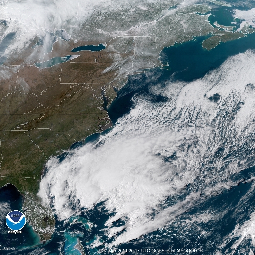
Look how empty this satellite is! Unfortunately, there will be a bit of overcast on the way. Whether or not that includes rain remains to be seen.