Savannah is a nice southern town, good for vacations, and things played out perfectly for out of town guests last week. First, temperatures overnight dipped into the 50s both Thursday and Friday morning which was cooler than had been anticipated, and then there was no shower or thunderstorm activity on Friday, as all the storms associated with a passing cold front were drawn north or shunted south of the city. Forecast.io was the only outlet to correctly call for a dry day, but Accuweather had cool overnight lows and secured the victory on their own. Actuals: Thursday, High 86, Low 58 Friday – High 82, Low 59
I don’t know how Savannah got it’s name. It’s spelled different than the African savannas. Maybe it’s just because it’s so danged hot, just like a savanna. The extra h is for “humid”.
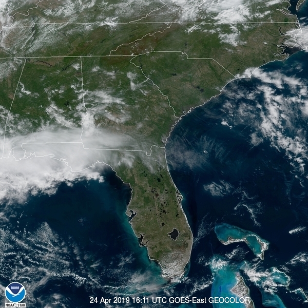
At 1153AM, ET, Savannah was reporting a temperature of 83 degrees with clear skies and a relatively manageable dew point of 59 degrees. There is a jet streak over the northern Gulf of Mexico which is at present providing the nearest cloud cover, as well as the nearest inclement weather, which is developing over east Texas and promises some headaches before the week is through in Savannah. Low pressure is developing in East Texas with a jet streak that will phase into a broader jet trough that extends into the Canadian Prairies. Expect Thursday to remain fairly tranquil, if hot and humid, but showers and storms will be primed to arrive on Friday morning. The association with the broader trough will mean less organization in the storms over Georgia, and the pivoting nature of most high amplitude waves will reduce the chance of a real influx of cold air Friday evening. It will still rain and potentially storm a bit, but Friday would be much worse if these two features didn’t merge. Tomorrow – Mostly sunny, increasing clouds, High 84, Low 63 Friday – Rain, maybe some thunder, generally clearing out in the afternoon, High 82, Low 64
TWC: Tomorrow – Partly cloudy skies in the morning will give way to cloudy skies during the afternoon. High 87, Low 62 Friday – Showers in the morning, then partly cloudy in the afternoon. Thunder possible. High 81, Low 67
AW: Tomorrow – Partly sunny; warm High 87, Low 61 Friday – More clouds than sun, a couple of showers and a thunderstorm; not as hot High 82, Low 65
NWS: Tomorrow – Mostly sunny,High 86, Low 64 Friday – A chance of showers and thunderstorms, then showers likely and possibly a thunderstorm after 7am. Cloudy, High 80, Low 68
WB: Tomorrow – Mostly sunny, High 83, Low 63 Friday – Showers with a chance of thunderstorms, High 83, Low 67
WN: Tomorrow – Mostly sunny, High 86, Low 64 Friday – Mostly cloudy with showers likely, High 80,Low 68
FIO: Tomorrow – Mostly cloudy starting in the afternoon. High 83, Low 61 Friday – Mostly cloudy until afternoon. High 81, Low 66
Forecast.iois so bold as to think this system is going to dissipate before it even arrives on the Georgia Coast. Here is the satellite imagery with clouds over the northern Gulf.