A strong ridge, even stronger than thought

Owensboro seemed to be a pretty easy forecast when we issued it last week. Well. A combination of a stout ridge at the upper levels and an infusion of warm air thrust northward by an advancing area of low pressure shot high temperatures well into the 60s, which was a sight warmer than anyone anticipated. The Weather Channel and Accuweather tied to have the “least bad” forecasts.
Actuals: Thursday: High 67, Low 35
Friday – High 65, Low 41

Grade: D

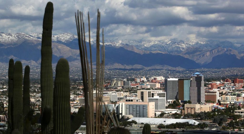
Tucson, Arizona to Owensboro, Kentucky

Two days, two road trips. This one will be another three day trip, covering 1,654 miles at a pace of 66mph. We’ll collect 529 miles on the first two days, and drive 9 hours to finish off the trip. With a system bubbling up in the southern US, this could be a bit of an interesting foray on the open road.

DAY ONE (Thursday)

Tucson, Arizona

It’s certainly not something we would expect, but there could be torrential rain in Tucson as we get underway on Thursday morning. Low pressure is rising out of northwestern Mexico into the desert Southwest, and will bring Tucson some torrential rain. The feature will lose it’s identity and a bit of it’s available precipitation as it drives into the Rockies, which will mean lighter rain as we pass into New Mexico. That lighter precipitation will continue to be possible, however, until Corona, but we will be dry through Santa Rosa, our day one destination. Unfortunately clouds will obscure the southern high Plains sunset.

DAY TWO (Friday)
The low will shift into the High Plains and intensify overnight Thursday into Friday, but the cold front will be well to our east by the time we get moving in the morning. It will be fairly windy and unusually cool from Santa Rosa through eastern New Mexico, the Texas Panhandle and west Texas. We will be moving quickly enough that we may catch up to the back end of the system as we approach Tulsa, our destination for Friday night.

DAY THREE (Saturday)
Unfortunately, our system is going to be moving to the north, predominantly, instead of to the east, which makes it easier to catch. There is a decent chance that the first contact will be with snow showers in central Missouri, from Springfield onward. It will ultimately transition from snow over to rain in southern Illinois and continue as such into Owensboro. Make no mistake, we will be mostly within the storm’s dry slot, which means light precipitation, or perhaps none at all, throughout this route, but the possibility is going to be ever present.

Owensboro, Kentucky

Owensboro, Kentucky

Owensboro on the Ohio, OK?

At 956PM, Owensboro was reporting clear skies and a temperature of 33 degrees. Most of the region was seeing clear skies, but to the north, a swath of mid layer clouds was cruising through the Great Lakes. In the southern part of Indiana and Illinois, a bit of fog was settling in.
A jet ridge is pushing into the area, which will encourage more stability in the Ohio Valley for the rest of the work week. Unfortunately, it portends an undulating jet structure, and a weekend that is likely to be less pleasant than the conclusion to this week.
Tomorrow – Mostly sunny, High 58, Low 32
Friday – Mostly sunny, High 61, Low 32

TWC: Tomorrow – Sunny, High 59, Low 33
Friday – A few passing clouds, otherwise generally sunny High 62, Low 33

AW: Tomorrow – Some clouds, then sunshine High 59, Low 33
Friday – Partly sunny High 59, Low 36

NWS: Tomorrow – Sunny High 56, Low 32
Friday – Sunny High 61, Low 34

WB: Tomorrow – Sunny High 57, Low 33
Friday – Mostly sunny, High 59, Low 35

WN: Tomorrow – Sunny, High 56, Low 34
Friday – Mostly sunny, High 61, Low 34

FIO: Tomorrow – Clear throughout the day. High 59, Low 44
Friday – Partly cloudy throughout the day. High 61, Low 33

Don’t get lulled into this pleasant weather for the end of the week, Owensboro. It’s going downhill this weekend. Here is KEVV out of Evansville with the regional forecast.