We looked at Longview in the middle of the month, when east Texas was in the midst of a stormy pattern. We expected that pattern to continue, and for a bit of cooler air to funnel into the region. At the very least, it seemed like overcast skies would conspire to keep it cooler. Not so much. In fact, the day with the most rain, Saturday the 20th, was also the day with the warmest temperatures. Temperature forecasts were not great, overall, but they were passable. The real differentiator, though, was the spot of rain seen early on Sunday. The top spot belonged to a trio, Victoria-Weather, Accuweather and Clime. I did forget to add the forecast for WeatherNation, so they get the consensus numbers. Sorry, WeatherNation. Actuals: June 20th, .55″of rain in thunderstorms, High 89, Low 74 June 21st, .01″ of rain, High 87, Low 75
The middle of the week has been rife with severe weather. There is more in the mid-Atlantic, but things are finally beginning to look a bit more relaxed. How relaxed in east Texas?
At 1153AM, CT, Longview was reporting mostly cloudy skies and a temperature of 73. The lingering boundary that has been a significant weather maker in the southeast this week now lay from Jacksonville, Florida to a secondary surface feature southeast of Texarkana. A band of showers and storms has slid southeast of Longview, but a batch of showers continues near Dallas, and a dry afternoon is unlikely. There is a low level perturbation seated over southern Missouri that is going to continue to enhance shower and storm activity through the day tomorrow. The more significant jet streak is shifting to the east, with a weak ridge snuffing out the weak low in the south central US. Further bringing about some stability to east Texas is a surface system developing in the Front Range late Saturday, shifting into central Plains on Sunday. This will lead to rising heat and humidity, but clearer conditions, with only a couple of pop up thunderstorms. Tomorrow – Scattered showers and storms, High 83, Low 73 Sunday – Clearing and warmer with isolated showers, High 90, Low 75
TWC: Tomorrow – Scattered thunderstorms in the morning. Cloudy skies late. High 83, Low 72 Sunday – Partly to mostly cloudy. High 88, Low 73
AW: Tomorrow – Humid with intervals of clouds and sunshine High 83, Low 73 Sunday – Humid with sunshine and some clouds; a thunderstorm in spots in the afternoon High 90, Low 75
NWS: Tomorrow – Showers likely and possibly a thunderstorm before 7am, then a chance of showers and thunderstorms after 7am. Cloudy, then gradually becoming mostly sunny High 90, Low 74 Sunday – Mostly sunny, High 93, Low 75
WB: Tomorrow – Mostly cloudy with a chance of showers and thunderstorms. High 83, Low 75 Sunday – Mostly cloudy in the morning then becoming partly cloudy High 89, Low 74
CLI: Tomorrow – Thunderstorm High 83, Low 75 Sunday – Thunderstorm High 90, Low 75
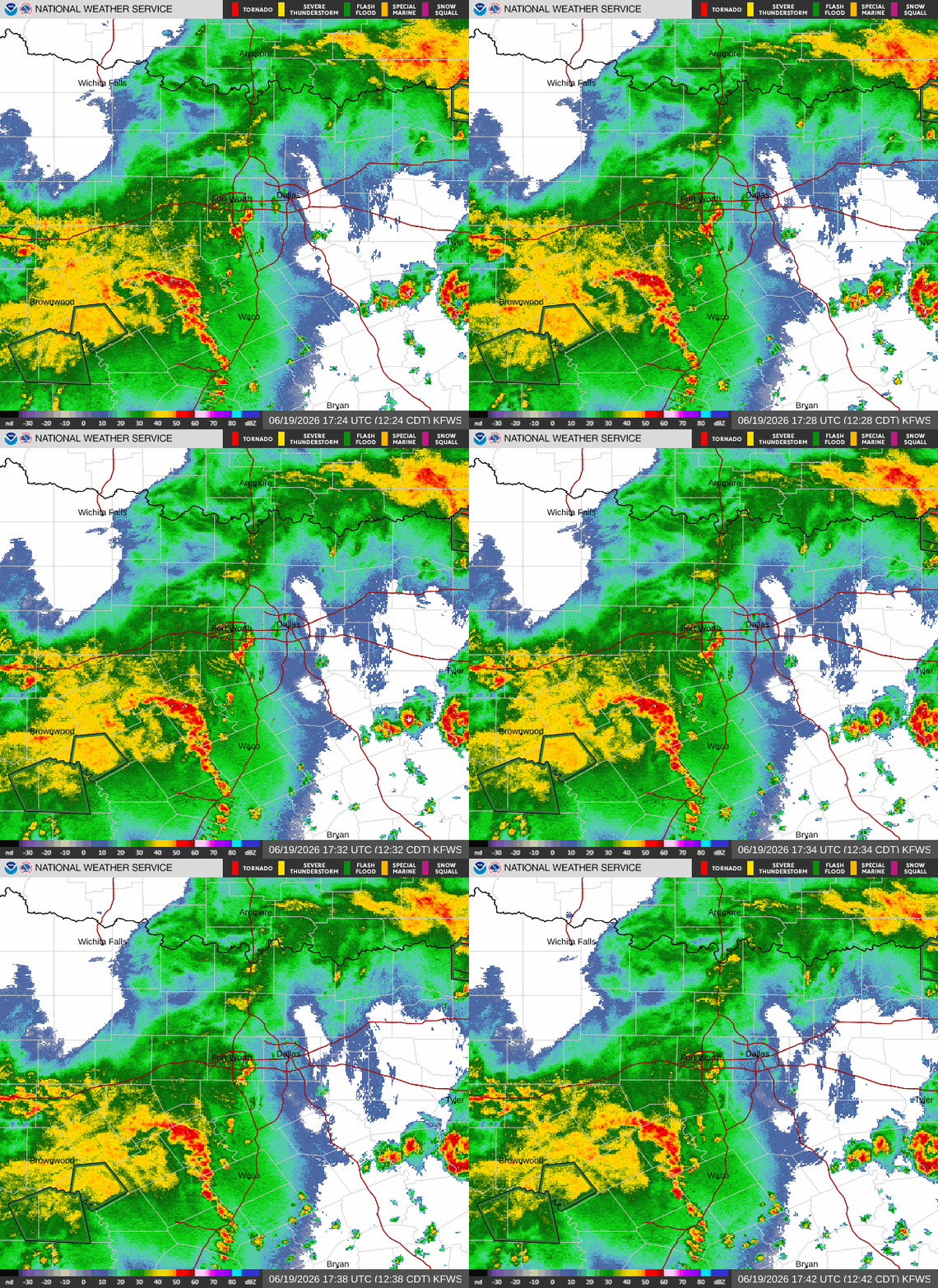
Undersold is that with the low pressure developing to the north, it will also be fairly breezy in Longview on Sunday. Just hot wind. Here’s the diminishing storm activity, depicted on radar!
The Dakotas have been some of the stormiest states in the country lately, and we are on our way there! It’s a pretty straight shot from east Texas to the farthest east portion of North Dakota. The drive is a two day slog, covering 1086 miles at a pace of 64.7mph. Day one will be a hair shorter than day 2, concluding after 518 miles. It’s the weekend!
DAY ONE (Saturday)
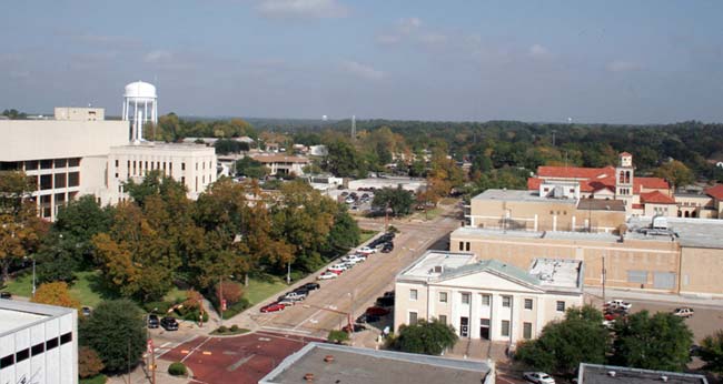
Longview, Texas
The culprit behind some severe weather today in northern Nebreaska is a short little wave on the back side of a broader low in Quebec. Short little waves tend to move very quickly, as will this one, shifting out of the Dakotas towards the western Great Lakes. Through Texas and Oklahoma, expect a more laminar, westerly regime, which will mean hotter, dustier air for our Saturday. As the day concludes, though, some instability in eastern Kansas could lead to a stray rumble of thunder at the tail end of our day. The activity will be scattered in nature while hugging the Missouri border, and we may just as soon be dry all the way to Hoyt, north of Topeka, by the end of the day.
DAY TWO (Sunday) High pressure will nose in behind the system, bringing some seasonably more favorable temperatures to our drive. Low 80s in the eastern Dakotas instead of the mid 90s. I think we might appreciate that for a bit, especially after leaving Texas. I know the locals like it too. Fargo isn’t so bad in the middle of July.