Showers and storms streamed up the western flank of the high pressure system that was parked over the eastern US earlier in the week. They were always going to be a threat for Des Moines, but they were bopped a little bit harder by a storm last Thursday. Smaller spots of rain drifted through throughout the rest of the forecast period, resulting in .5 inches of rain falling through the 2 day period. Weatherbug continued a good month, and netted the top forecast. Actuals: Thursday – .45 inches of rain, High 73, Low 64 Friday – .05 inches of rain High 79, Low 68
Des Moines is the destination for today’s forecast. I was just there for Easter, so I feel like I should have their forecast pretty well locked down.
At 936AM, CT, Des Moines was reporting a temperature of 68 degrees with overcast skies. While there was no rain presently seen in the Des Moines area, a batch of activity was moving through the Omaha area, and overcast riding over the top of a tropical airmass was shifting north behind a warm front, and smothered most of the Upper Midwest, particularly east of the Missouri. There was a strong ridge over the eastern 3/4ths of the US, but a weak undercutting trough was providing for some rough weather in the south central US, and the exit arm of the trough was helping usher in the soupier air mass across Iowa. The undercutting trough is expected to fold back into the primary jet, while the surface ridge should start to retrograde a little over the next 24 hours. This will strengthen the return flow, and only stand to make Iowa more humid. A Canadian trough will dangle a cold front into Minnesota, but it won’t be strong enough to organize much convective activity in Iowa, however the latent moisture of the area, along with the brisk flow on the back end of the ridge in the Eastern United States will be enough to provide for garden variety showers and isolated storms through the day tomorrow and into the early afternoon on Friday. The ridge will build in at a more fortunate angle to dissuade more moisture from driving into Iowa, and it should switch off the threat for storms by nightfall. Tomorrow – Scattered showers and thunderstorms, otherwise stuffy and partly cloudy, High 75, Low 63 Friday – Showers and storms early, then clearing but still muggy, High 80, Low 65
TWC: Tomorrow – Mixed clouds and sun with scattered thunderstorms High 76, Low 65 Friday – Scattered thunderstorms, especially in the afternoon. High 80, Low 66
AW: Tomorrow – Cloudy; a couple of morning thunderstorms followed by a shower in the afternoon High 74, Low 64 Friday – Remaining cloudy with a couple of thunderstorms High 81, Low 66
NWS: Tomorrow – A chance of showers and thunderstorms, then showers likely and possibly a thunderstorm after 2pm. Cloudy, High 76, Low 64 Friday – A 40 percent chance of showers and thunderstorms, mainly before 2pm. Partly sunny, High 82, Low 66
WB: Tomorrow – Showers likely and a chance of thunderstorms. High 73, Low 64 Friday – Partly sunny with a 40 percent chance of thunderstorms, High 78, Low 66
WN: Tomorrow – Mostly cloudy with light showers likely, High 76, Low 64 Friday – Partly cloudy, High 81, Low 68
FIO: Tomorrow – Possible light rain until afternoon. High 77, Low 65 Friday – Mostly cloudy throughout the day. High 79, Low 67
This is a real summer time pattern. An open flow from the Gulf, but no real organization to do anything with it. It’s early in the season, so it seems glum, but it should warm up pretty quick when the sun comes out.
One of the thing that tempers the opinion of this nascent cooldown east of the Rockies, is that the past few weeks, especially towards the Plains and Mississippi Valley have been very pleasant. Take Des Moines, where some thunderstorms on the 22nd and 23rd, during our forecast period, had the courtesy of falling overnight, and highs rose to the upper and mid 70s, outpacing forecasts ever so slightly. The Weather Service had the top forecast, though many outlets were punished for failing to mention the threat of wet weather. Actuals: Wednesday April 22nd, Trace of rain, High 78, Low 51 Thursday April 23rd, Trace of rain, High 74, Low 52
At 854PM, CT, Des Moines was reporting a temperature of 58 degrees with clear skies. There was certainly a warm front just to the west, as even at this hour, Lincoln, Nebraska was sitting in the low 70s. Low pressure further to the south was intercepting any moisture, so the warm air will lift into Des Moines overnight without much impact. The southern low will shift eastward and remain south of of the Hawkeye State. Some moisture folded into the feature will wrap back to the north during the day tomorrow and lead to overcast skies at times with some light drizzle. The feature will shift further east overnight Wednesday into Thursday, with dryer air building in for a sunny day on Thursday, though late in the day, another trough will begin to drift in from the west. This will be weaker, but with better access to moisture for the Des Moines area than the two features previously, and some late rain or thunder are possible Thursday night. Tomorrow – Mostly cloudy to overcast, with a chance for drizzle. High 76, Low 48 Thursday – Very early and very late rain possible, but sunny during the day, High 68, Low 50
TWC: Tomorrow – Partly cloudy with afternoon showers or thunderstorms High 76, Low 51 Thursday – A few passing clouds, otherwise generally sunny High 70, Low 48
AW: Tomorrow – Some sun, then turning cloudy, breezy and warmer (Late rain) High 74, Low 50 Thursday – Some sun, then turning cloudy, breezy and warmer High 70, Low 50
NWS: Tomorrow – A 40 percent chance of showers and thunderstorms, mainly after 3pm. Partly sunny, High 76, Low 49 Thursday – Mostly sunny (Late rain) High 70, Low 49
WB: Tomorrow – Partly sunny with a 40 percent chance of thunderstorms. Warmer. High 71, Low 50 Thursday – Mostly sunny (thunderstorms early and late) High 69, Low 51
WN: Tomorrow – Partly cloudy with scattered storms, High 76, Low 49 Thursday – Partly cloudy, High 70, Low 49
FIO: Tomorrow – Partly cloudy throughout the day. High 76, Low 51 Thursday – Partly cloudy throughout the day. High 73, Low 51
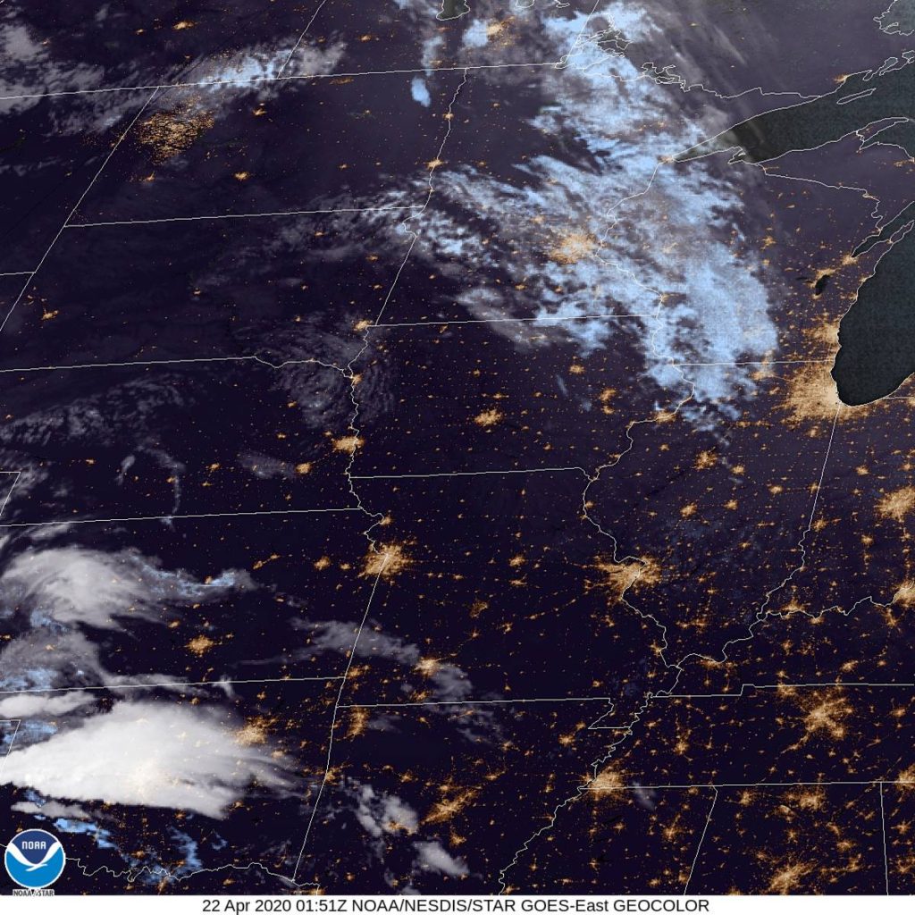
Here is the night’s satellite, showing Iowa to be nice and clear tonight.