It was a warm, rainy Christmas for the middle of the country, and just generally warm in the eastern third. The only areas that got a more traditional Christmas were in the northern High Plains and Rockies, which accounts for a very small fraction of the nation’s population. It’s all part of a month long trend, where temperatures have been warm enough that it’s inescapable that this will be the warmest December on record for a lot of places.
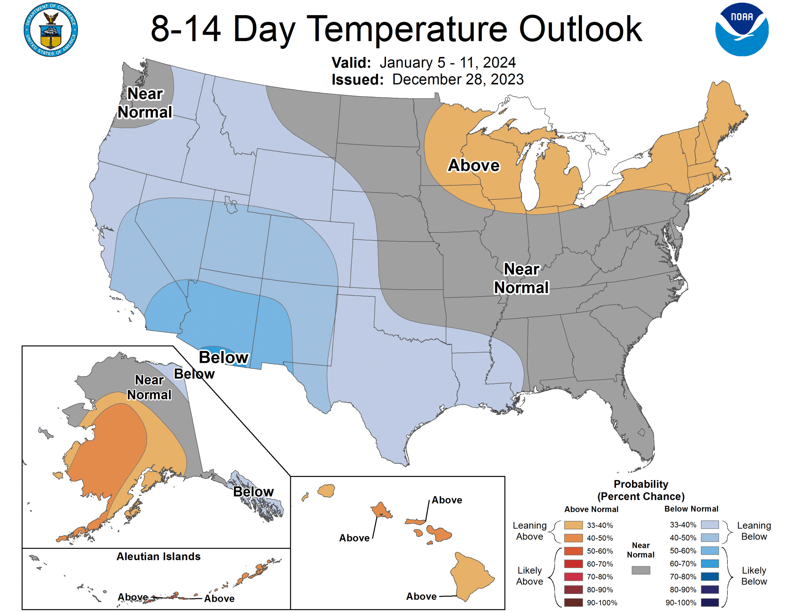
Temperatures to start 2024 look like they will continue to be warmer than normal, even after this first cold intrusion the country is undergoing in what seems like months. The jet is going to become established over the southern US at the same time, though, and this is going to start paying dividends, in the form of temperatures coming in line with normal, or in the southern US, cooler than normal.

The south riding jet is going to allow cool air to filter into the lower 48, but that isn’t the whole story. This jet will be strong and wavy, which means it will be active as well. An atmospheric river, so to speak. The strong areas of low pressure moving from the southwestern US and through the southern tier of states will help in keeping temperatures suppressed. To the north, where it is less likely to cloud over during the day, temperatures won’t end up on the cold side of normal. ‘
Right around normal is still awfully chilly for the northern US, so winter is going to feel more like winter. If that is too much to handle, then rest assured, things are going to get warm fro a lot of the country once again by the end of the month, according to the CPC’s forecast.
