
Earlier this week, Supertyphoon Mawar swiftly intensified, then crashed through Guam as a Category 4 storm, the strongest in memory for the US dependency. Damage is extensive, power is out to the island and the recovery will be long and hard. Two men lost their lives, which is tragic, but also a lower figure than one might have anticipated. Mawar only strengthened after passing over the Mariana Islands, but if forecasts are accurate, Mawar will not go down as one of the typhoons of legend in the western Pacific.
There is some model consensus on Mawar’s future. An area of low pressure is expected to move out of eastern Mongolia and northeastern China, across the Korean Peninsula and into the north Pacific. It will drag a cold or stationary front westward and south through China. This will have an effect of bringing Mawar to a full stop, northwest of Luzon in the Phillippines and east of Taiwan, two major population centers.
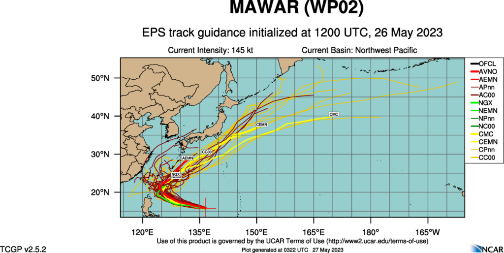
Mawar will still get close enough to both islands to bring high surf and the portential for a little storm surge, especially given the proximity suggested by some models to Taiwan, but we aren’t expecting a direct landfall of this strong storm on either. Then, as Mawar weakens, it will turn north towards, but ultimately southeast of the home islands of Japan, another crisis averted.
That certainly isn’t to say that Mawar will be totally unimpactful after Guam. The storm will move swiflty through the Bonin and Volcano Islands, the most famous of which for Americans is Iwo Jima, which is presently uninhabited. There are also important shipping channels that will be disrupted while the storm churns between all these commercial venues.
There is plenty of time for the tropical season to take a more sinister turn, but for now, we tentatively have had a stay.