
Its forecast time, friends! It’s been stormy to begin May in Iowa, and the nearby town of Coralville was winged by a tornado not a month ago. I suspect we will enjoy a bit more tranquil weather this week.
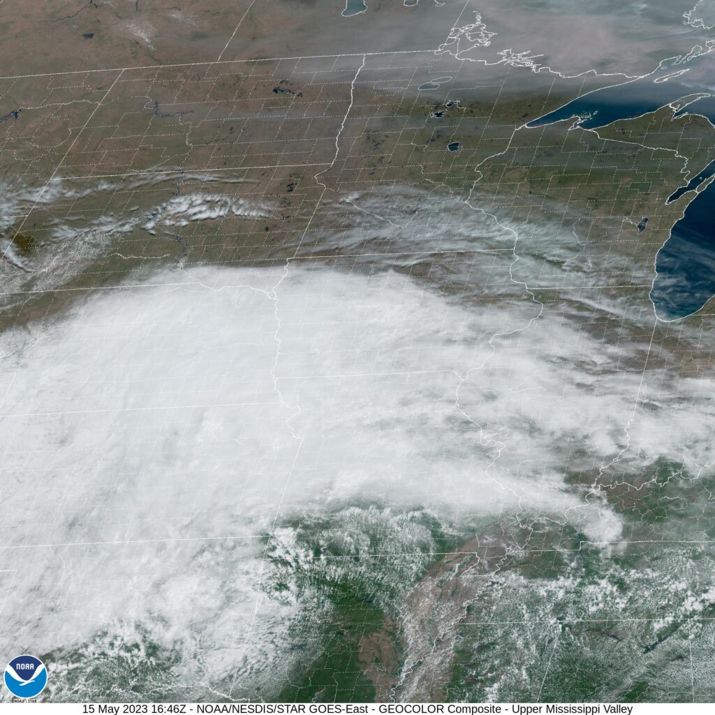
At 1152AM, CT, Iowa City was reporting mostly cloudy skies and a temperature of 62 degrees. It was a bit cooler than might typically be expected in May in eastern Iowa, thanks to low pressure parked over eastern Kansas. In fact, Iowa City was a bit warmer than points westward, where a northerly flow was pressing into the region. Upper level flow is weak, so a look towards lower levels will help dictate the weather through the middle of the week.
As the low center moves nearly due eastward through the Ohio Valley, mostly cloudy to overcast conditions will remain in place through tomorrow morning. Finally, there will be a breakthrough in the afternoon, with sunnier skies and warmer temperatures. The tail of a cold front will slump southward through the Upper Midwest, drawing some southerly flow to the region, followed by a dip in temperatures as flow switches to northerly once again on Wednesday
Tomorrow – Mostly cloudy, High 76, Low 55
Wednesday – Mostly cloudy, High 72, Low 53
TWC: Tomorrow – Partly cloudy. High 80, Low 54
Wednesday – Partly cloudy. High 76, Low 51
AW: Tomorrow – Pleasant and warmer with times of clouds and sun High 81, Low 54
Wednesday – Mostly sunny and beautiful High 76, Low 52
NWS: Tomorrow – Mostly cloudy, then gradually becoming sunny, High 79, Low 53
Wednesday – Sunny, High 73, Low 52
WB: Tomorrow – Partly sunny in the morning then clearing. High 78, Low 53
Wednesday – Sunny, High 75, Low 53
WN: Tomorrow – Partly cloudy, High 79, Low 53
Wednesday – Mostly sunny, High 74, Low 52
CLI: Tomorrow – Partly cloudy, High 77, Low 52
Wednesday – Sunny, High 73, Low 52
Quite a bit of overcast for the state of Iowa this afternoon, but a warm up is on the way.
Comment (1)