
Late August usually brings out the posts about the coming tropical season and the increasing threat. The peak of the tropical season is less than a month out, and while the NHC continues to forecast a busier than normal season, the Atlantic remains quiet. So we turn our attention to the rest of August in the continental US.
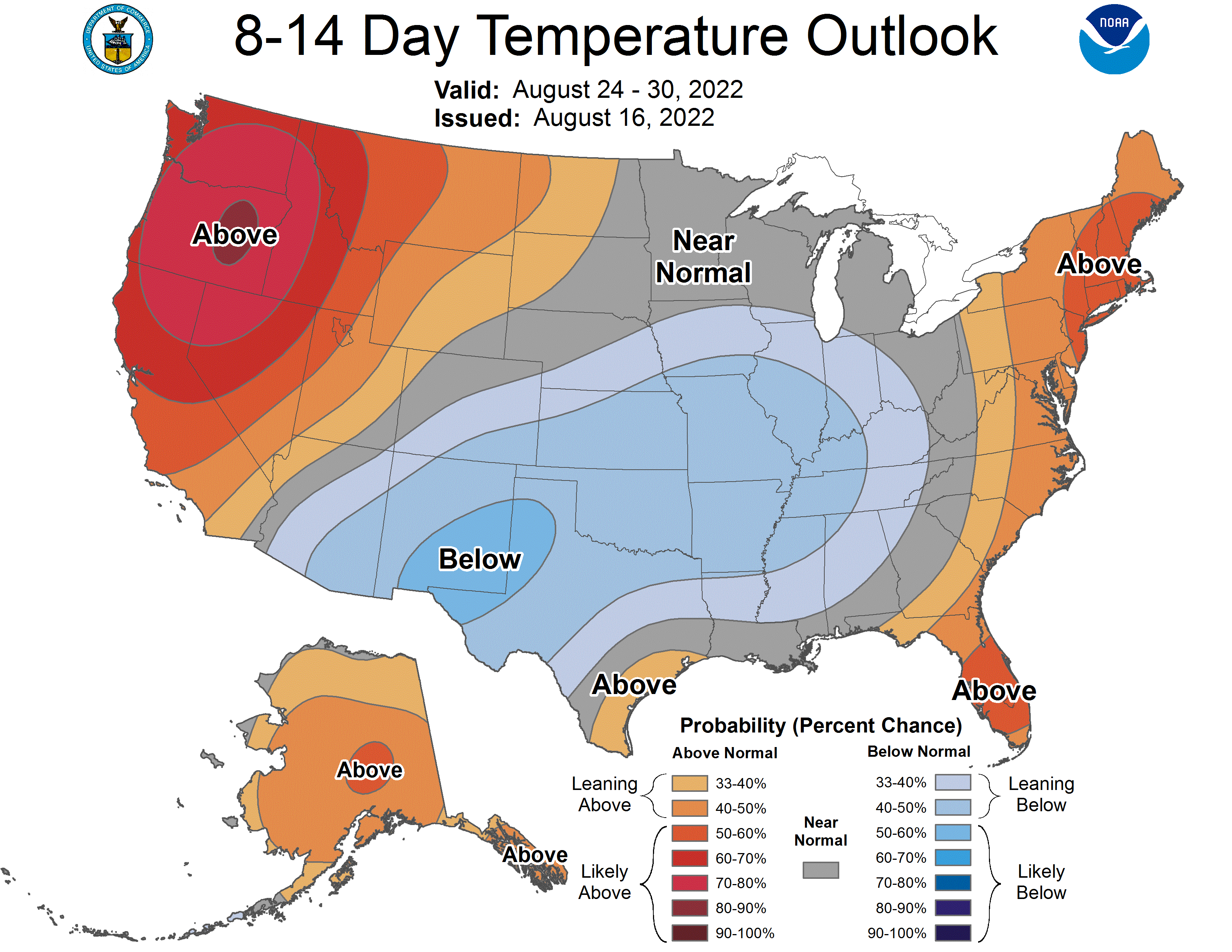
The 8-14 day outlook from the CPC has much of the country in below normal temperatures. This is accompanied by above normal precipitation in the same regions, and as a reminder that summer is still around, a heat wave on the west coast.
Oceans continue to warm through the summer as the sun angle stays strong, which is why late August and September are busiest in the Atlantic, but over large landmasses, air masses are more vulnerable to changes. While the sun is warming the oceans, the angle is reducing, and the jet starts sinking south. There is more variability in the weather pattern, and when there is variability, there is the threat for thunderstorms.
There might be some instinct to believe that the extremely divergent temperatures relative to normal found on the coasts versus that in the middle of the country. Looking at the upper level pattern, though, this doesn’t quite seem likely. Typically weak summertime flow is going to continue until late in this outlook period, which means these cooler temperatures will probably be a result of moisture and cloud cover thanks to an array of surface perturbations.
Shorter waved features are more spurious, and is why there is less confidence in the below normal temperature field than with the warmer regions, which are a result of strong jet stream ridges in the forecast. There isn’t the full level cold air mass in the middle of country to provide the clash of airmass you need for big severe outbreaks. There will certainly be some thunder embedded within all the rain coming Middle America’s way, but not high risk days from the Storm Prediction Center.
Generally, there is usually a late year severe weather peak at the beginning of fall, as cold air really starts to come back to town. Unlike the spring severe season, cold air is denser and tends to completely supplant warm air. Cold air is reinforced, and warm air has a tougher time coming back, so the severe season is shorter than spring, where warm air keeps trying to bubble up.
Like the tropical season this year, we shouldn’t read to much into this quiet October. The hurricane season, like the fall severe season could still get very interesting very quickly.