Let’s head on out to California to finish this busy day of posting.
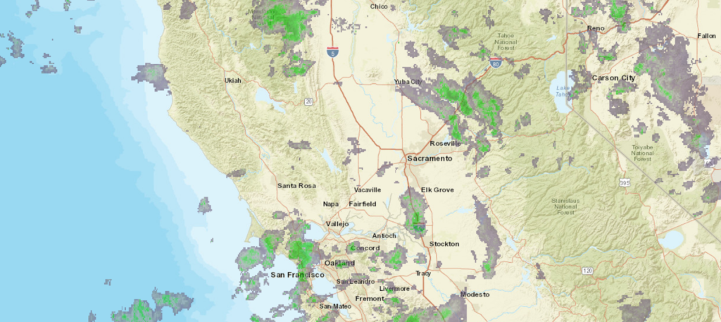
At 653PM, PT, Sacramento was reporting a temperature of 44 degrees with mostly cloudy skies. A broad trough aloft was contributing to a smattering of valley rain and mountain snow across the western US, generally from the Rockies to the coast. The surface low showed circulation centered off the coast from Point Arena, northwest of San Francisco Bay. Aside from that, surface features were ill defined.
The trough responsible for the inclement weather is bringing cooler air to the region as well. It’s axis is directed southwest to northeast, and that will slow its progression to the east. Unbound to the south, it will sink away a bit from Sacramento through the end of the week, leading to sunnier skies on Friday. Sacramento will still be within a general trough, however, and temperatures will remain cool, even if skies clear.
Tomorrow – Overcast with rain through the day, High 58, Low 40
Friday – Sunnier and warmer, High 65, Low 37
TWC: Tomorrow – Partly cloudy. High 59, Low 39
Friday – Mainly sunny. High 67, Low 37
AW: Tomorrow – Times of sun and clouds High 57, Low 39
Friday – Intervals of clouds and sun High 67, Low 34
NWS: Tomorrow – Mostly cloudy, then gradually becoming sunny High 58, Low 40
Friday – Sunny, High 66, Low 37
WB: Tomorrow – Mostly cloudy in the morning, becoming partly cloudy, High 58, Low 40
Friday – Patchy Frost in the morning. Sunny, Warmer, High 66, Low 36
WN: Tomorrow – Partly cloudy, High 58, Low 40
Friday – Sunny, High 66, Low 37
FIO: Tomorrow – Partly cloudy throughout the day. High 59, Low 40
Friday – Clear throughout the day. High 66, Low 37
I’m the only one saying that there will be rain tomorrow. I think we all agree that clouds and murk will linger in Sacramento, and snow will plaster the mountains outside of town.


Comment (1)