
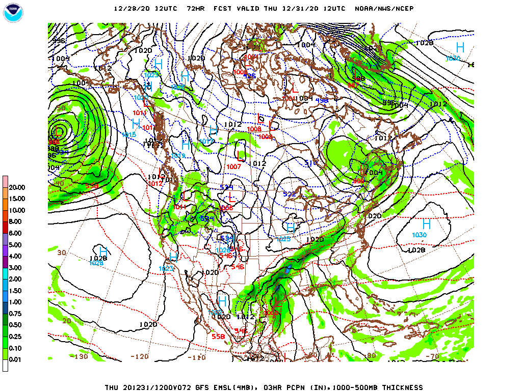
As is often the cast with mid-winter systems, a deep upper level trough will feature two iterations. The first will be a fast moving area of low pressure moving through the upper Midwest with a burst of snow in the Upper Midwest and Great Lakes. The second will emerge as the base of the upper trough pivots further south into warmer air, a stronger feature will develop.
In this case, the deep, secondary low will really emerge over east Texas. Tightly wound and with the clash of air masses one needs to generate some convection.
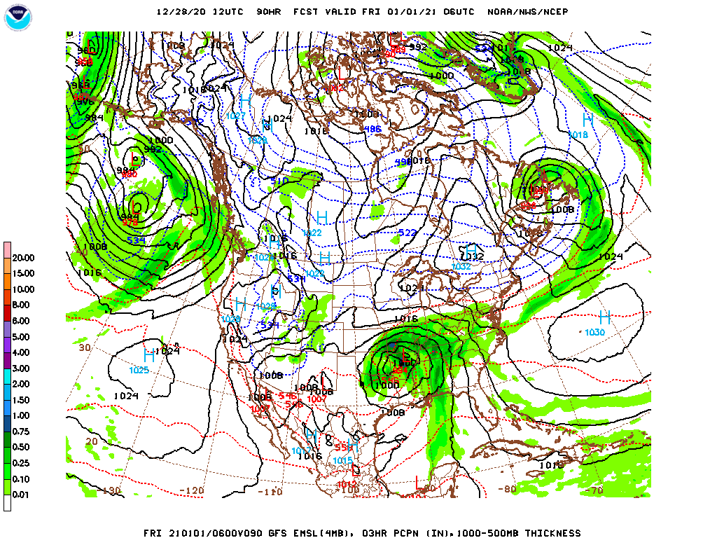
The storm will quickly shift to the northeast and get more organized as it does so, introducing a threat for severe weather in the Lower Mississippi Valley as it does so.
Here is the risk for severe weather on New Years Day, or Day 4 in the SPC parlance.
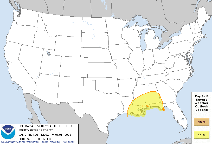
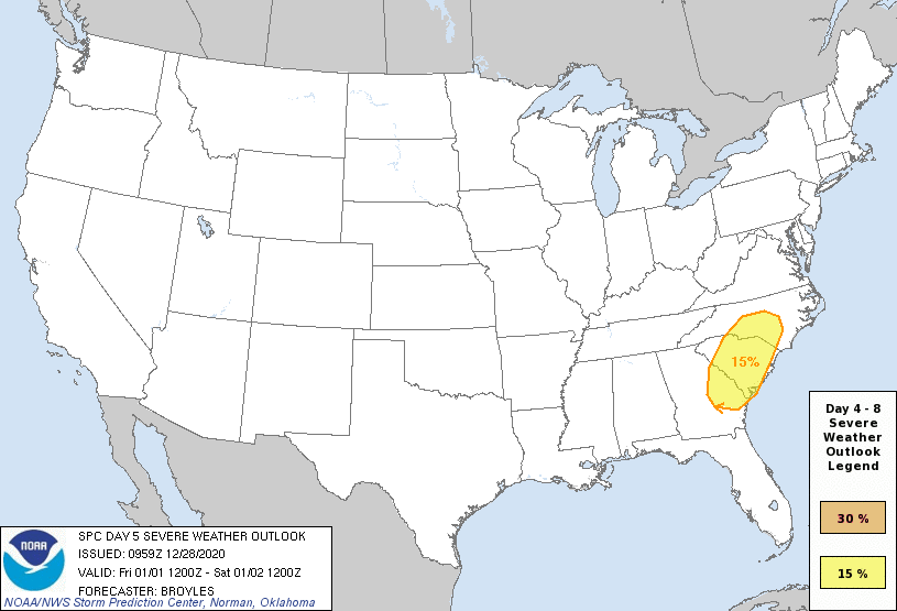
If there is one good thing about the timing of these storms, it is that their intensity will require day time heating, and overnight severe weather is not expected. Still, as the storm continues to lift to the north-northeast, severe weather is already on the agenda for January 2nd as well.
The back end of the storm isn’t going to be nearly as moisture rich as the warm sector, in good spring fashion, but there will still be snow associated with the feature, particularly through the Great Lakes.
2020 is finally almost over, but 2021 really wants to give us it’s best shot right out of the gate.