We’ve made it to the middle of summer, and the biggest summer holiday of them all. Some fireworks displays are still on, while others are cancelled out of an abundance of caution with the continued coronavirus pandemic. Whether or not we will get the patriotic displays, the atmosphere is certainly going to feel as it should on the 4th of July.
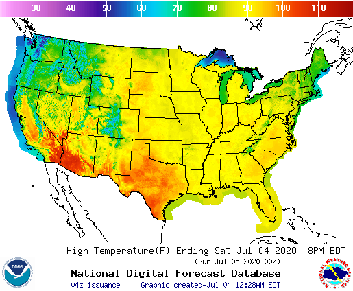
It’s going to be very hot for a lot of the country for Independence day, with 90s blanketing much of the country, save for the Pacific Northwest, where significantly cooler weather will take hold.

The overall pattern isn’t terribly strong, atmospherically, given there is a mountain range between the two air masses. There isn’t a vibrant jet structure to give rise to a solid dome of high pressure, but there isn’t organized low pressure either. Instead, we are looking at a pattern that will rely heavily on lower level features, which are provided more by the physical features at the surface than patterns in the atmosphere.
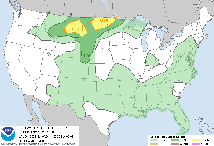
There is low pressure off shore, and sea breezes and weak oceanic circulation will lead to showers and storms along the east and Gulf coasts tomorrow. Lee troughing under zonal, west to east flow will lead to enough instability to lead to strong storms in the Plains, especially the northern High Plains, as noted in tomorrow’s SPC outlook map.

Large swaths of the country are going to be able to enjoy time on the lake or at the cabin, or perhaps watching fireworks displays from their decks or balconies. Socially distanced, of course.
Have a safe and happy 4th of July, everyone.
