
It is cold this morning in the Upper Midwest. For the second morning in a row, temperatures dropped to the double digits below zero across the regions. It’s the coldest it’s been all season, but there will be a bounce back this weekend, back to near freezing, if not above.
This little cold snap is not the last gasp that I am talking about.
The cold snap I am referring to is the one forthcoming. It may not be too terrible in the north central United States, relatively speaking, but look at this spate of blue on the 6-10 day outlook from the CPC.
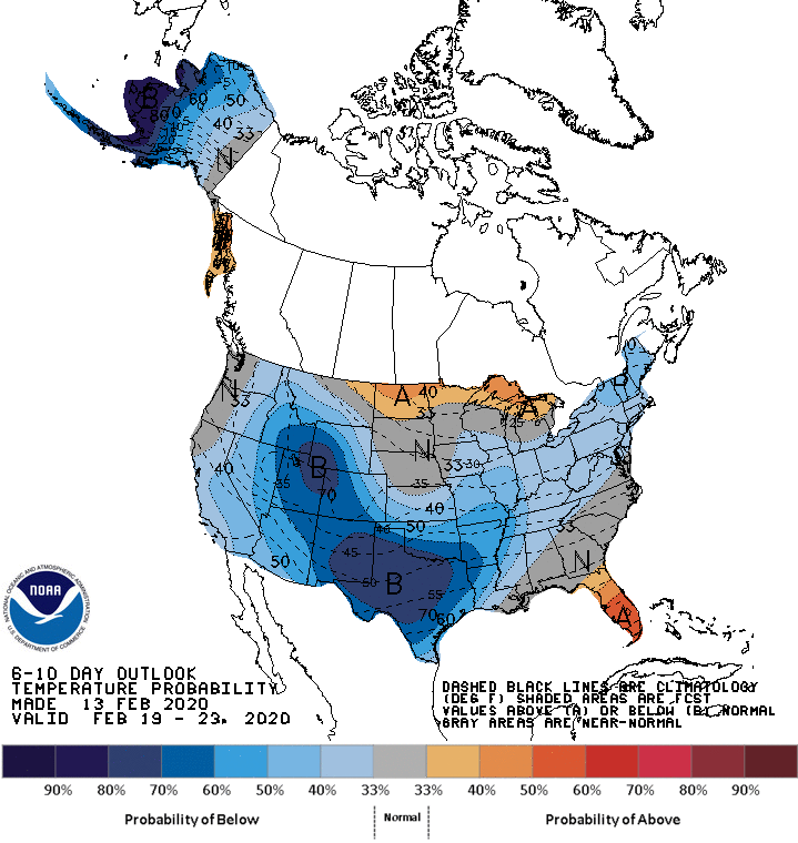
That’s a peculiar outlook, I will be the first to admit, and it has everything to do with systems generating in the Rockies, diving into the Big Bend of Texas and then shuttling off towards New England.
The good news is, much of the cool down is going to owe to the precipitation in the region, rather than an Arctic intrusion, which means, among other things, that despite the high precipitation and unseasonably low temperatures, west Texas probably won’t see accumulating snow out of this.
While this will be the pattern for the end of February and into the beginning of March, it will not hold through all the way through spring. Indeed, as luck would have it, this map will once again reverse for the rest of the season, as the north central US will be the spot most liely to endure a below normal spring.